France
Croissants!
Croissants!
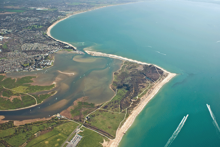
Le Touquet 16 Sep 07
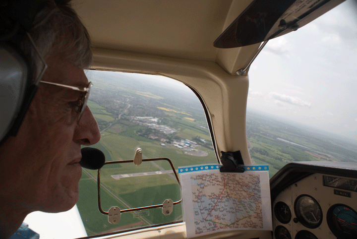
To make the best of the great flying weather we book a Sunday for lunch in Le Touquet. The previous day I learn how to file a Customs Declaration and flight plan (very easy, actually) at the Base Ops office and we're ready to go.
PFT want somebody who has been across the Channel before to go with me the first time, which is actually very wise as the channel weather can be horizonless and unless you've actually experienced it, it can be very disorientating and potentially fatal. So we're taking Wayne, who is good fun.
Dead reckoning navigation, as taught in the PPL syllabus, only realistically works where there are easily defined visual reference points: it's hard work, not very accurate and most places are pretty featureless, so you have to zig-zag your way around the countryside between "town with canal and white horse" and "town with large white chimney and Eastern bypass". It's desperately easy to confuse towns and even a small fluffy cloud can obscure the large white chimney.
 Commercial aviation gave up on dead reckoning 60 years ago and switched to NDBs (complex to use, limited range and susceptible to various accuracy-reducing issues) and, then VORs (long range, very accurate and dead easy to use). Over land, this is what the airliners use, and if it's good enough for EasyJet it's good enough for me.
We'll fly between PEKOX, BNN, LAM, DET, LYD and LT, a meaningless set of symbols that, translated in to the frequencies of the base stations these letters represent, give us the ability to fly accurately between them, regardless of cloud conditions.
 We fuel, and within 5 minutes of an early morning take-off in to hazy sunshine we are comfortably settled on to a VOR radial and we simply follow the beacons around the North side of London, broadly following the M25 then South East paralleling the M20 before swinging South to Lydd. Apart from one stupidly miscalculated VOR bearing on my plan that has us scratching our heads and zig-zagging between plan and correct track over the Medway Estuary, all goes well.
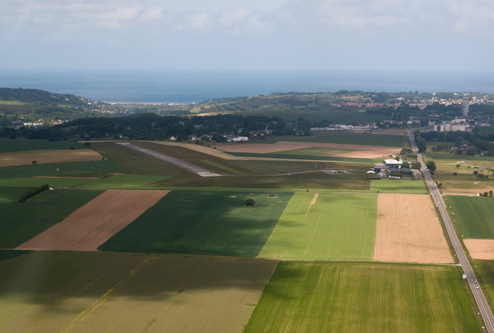
Controlled airspace for Heathrow, Luton, then Stansted preclude us from climbing higher than 2,400ft until we are well South of London, then layers of cloud force us to stay at the same height. Finally, the clouds clear and we climb to 5,500ft over the coast near Lydd.
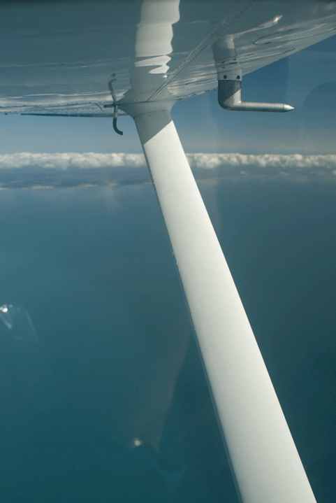
 It's 43 miles to Le Touquet, we've got a VOR capture, most of a tank of fuel, lifejackets, two GPS units, two PPLs and a Flight Information Service from London......
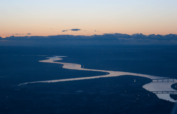
Half way across we change to Le Touquet radio and the clouds force us down to 2,500ft again; I'm getting nervous. On the radio a pilot diverts back to the UK citing low cloudbase, I'm considering the same but suddenly I see the French coastline and Le Touquet give us a straight in approach for runway 14 that we can't yet see, so we pick up the glideslope and pick our way under the cloudbase. A final dark grey barrier of cloud 5 miles out from the runway forces us down to 1,000ft but we know we're on line and we can land on the beach if the engine cuts, so we pop under it and suddenly there's the runway in just the right place. Damned clever, these glideslope-thingys.....
A tidy but well-crabbed approach, flare over the numbers a few feet high, achieve a "firm" landing, but we don't bounce and given the crosswind I doubt anyone could have done hugely better. After a little nosewheel shimmy (cured by lightening the nosewheel by raising the nose), I manage to stop before the centre taxiway, and..... what's this, a 14-year old on a bike gesturing for us to follow him. As we reach the parking spot, he slews his bike round, leaps off and marshals us in to our space. Very neat. In England Health and Safety would have banned him in a moment, he wasn't even wearing a Hi-Viz vest.......
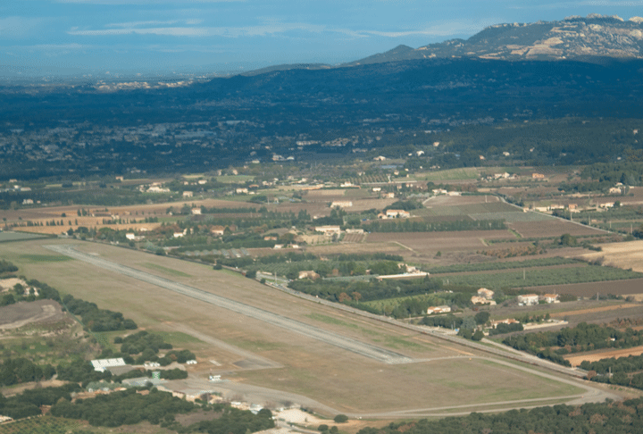
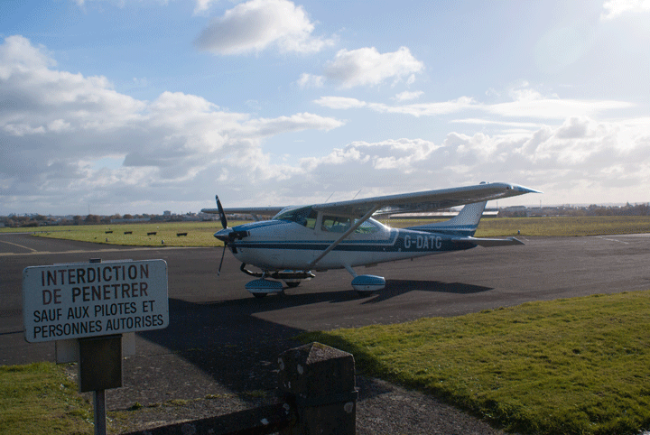
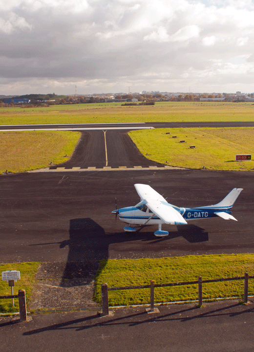
Le Touquet is the most relaxed airfield I have ever seen: people wander in and out, the landing fees are all written in to a book together with your bicycle loan fee (because everybody cycles in to central Le Touquet) and you then wheel your bicycle through the Arrivals lounge. Passport control, what's that?
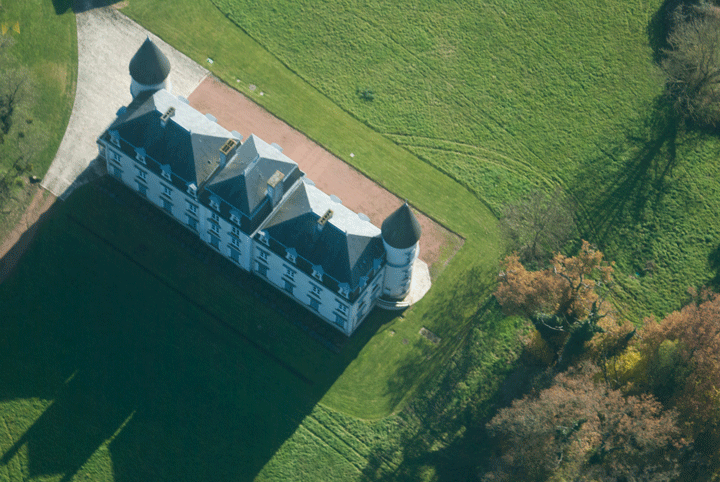
 The airfield is at the back of a huge, wooded area filled with beautiful houses on good-sized plots. Our planners would have quadrupled the housing density in an instant, but this is France, and they Do Things Better here.......
A 10 minute gentle cycle over quiet wooded roads gets us in to central Le Touquet, where we padlock the bikes in the pedestrian-and-bike-friendly centre of town, and have a bloody good, relaxed lunch in the warm sun at a pavement café.
Two hours later, we wobble back to the airfield encumbered with too much lunch and too many bags of chocolate cakes, wheel our bikes in through the Departure Lounge, pay our fees to the nice lady, file a flight plan (crib off the outbound one, this is easy!) and wander out to the aircraft. We could have been anyone wandering out there, but the French have a more relaxed attitude to General Aviation, which is perceived as a Good Thing.
And we do have a Cessna key.....
The apron is packed with British pilots enjoying the French hospitality; glad we came early.
 Pre-flight the Cessna, blast off on the reciprocal runway we landed on and just keep heading North West. The low clouds have dissipated but now it is the aforementioned horizonless haze, exacerbated by Wayne who decides it's time I had an impromptu instrument flying lesson and sticks the map over the windscreen for the entire crossing. Apparently I fly more accurately when I can't see out; presumably less distractions....
Interestingly, I learn that whilst keeping the wings absolutely level using the Artificial Horizon you can still go quite happily off course just by a little unnoticed adverse yaw, so the Direction Indicator is just as important a part of your scan. Good practise.
Back to London Info for a Flight Information Service half way across, then we are back over the coast at Lydd and I get to see out again. Apparently I am now suitably initiated in to the art of horizonless flying (just trust the instruments).
It gets really bumpy as we head North then West, I concentrate on really accurate VOR flying and we bump our way home. For most of the flight I simply concentrate on tracking the VORs and manage it within 5° all the way back to the Chilterns where we switch back to the Mk1 eyeball and get an Oxford ATIS: ooh er, 240° 15 gusting 28Kts 50° off runway 19: that's way outside my limits and the Operating handbook limits.
 A quick bit of panicked thought: I either chicken out and let Wayne land it, divert to Enstone that has a 26 runway, or we could try the grass runway 21. I vote for the grass runway: it's still a bad crosswind but it's within limits.
Request to Join Left Base for "grass runway 23" at which the Tower corrects me. Well, of course I meant "21".....
Descend, report 5 miles, mind Danger Area 129 which is Active, and this time knowing that the super-slippery Cessna hates to descend perform virtually a glide approach to the Threshold. The headwind is such that at an IAS of 75Kt, according to the GPS, our groundspeed is 45Kts. Gulp..... I'll give it one heavily crabbed go and at the first sign of trouble I'm off again.
But it's an anti-climax: I flare, hold the nose high and we bump and trundle, I keep the nose gear off for as long as possible then brake and even manage to exit neatly at the runway mid-point. It's not until we've vacated the runway that I realise the flaps are up: Wayne apparently raised them immediately we touched down to dump all the lift. Neat trick! It's not until we open the doors that we realise it's blowing a gale across the airfield, it's really cold and everybody else has long gone home.....
So now I'm checked out to fly across the Channel we can go to Le Touquet whenever we want, which we most definitely will
Beauvais 19 Apr 10
My brother-in-law and his daughter go ski-ing in France, the Icelandic ash cloud intervenes and the airlines strand them in the Alps, so they grab a hire-car and drive to Beauvais, from where we agree to rescue them.
 A fair amount of research and some study of ASHTAMs show that flying in the ash cloud is quite possible as unlike gas-turbine (jet) aircraft, piston-engined aircraft have air-filters. Unless we hit a very large concentration of ash it should not be an issue. So we’ll go.
Pete agrees to come with me: he’s flown in France a lot more than I have, and speaks better French so will be a handy co-pilot. We agree that any sulphurous smells in the cockpit we will move away from, either horizontally or vertically.
The previous evening we have fun with the HM Customs paper GenDec form: apparently we have the old version, so have to do a revised version. Typical - why can't we do it on-line?
It’s cold and early as we A-check and start up. We are the only aircraft flying, and the radio frequencies are very quiet. We change to Benson, who aren’t even awake, so make blind calls through their zone and head on to Farnborough.
Our flight plan routes us through Farnborough's overhead, which might be an issue normally, but today the jets are all grounded and the apron is full of very expensive-looking hardware.
South East from Farnborough we pass North of Shoreham, over Brighton and Seaford, coast out and change to London Info; give them an estimate for the FIR boundary and climb to FL55. I like a bit of height over water: it gives a (false) sense of security but more importantly more time to restart the engine, and if that fails get the PLBs out, find a boat to land ahead of and don lifejackets before you hit the water.
It's very hazy and there is no horizon at all, which could be disorientating. The auto-pilot does help, and our GPS tracks are amazingly straight lines which goes to show how much better a mechanical device is at holding a heading.....
At the FIR boundary (codenamed XIDIL, apparently) we swap over to a super-sexy sounding female French controller who babbles away in French to the French pilots but speaks great English for the Brits. She helps us coast in at Dieppe and we start a cruise descent for Beauvais.
The French maps show a series of red military low-flying routes around the country: I didn't realise but now do that these are not always active and there is a website you can check their status on here. Very handy indeed: you don't want a Mirage up your tail at 700Kts! So we don't have to descend to 1,000ft in an area of very tall radio masts after all....
 The haze persists as we descend and change to Beauvais approach. They have 2 runways, and we know one is down for maintenance. But they offer us 13 or 31 (same runway, opposite directions, as there is no appreciable wind) and we opt for a straight-in approach (when we can see it...). We follow the ILS for both vertical and horizontal guidance as although we can see the ground beneath us the runway remains persistently invisible. They ask us to report Long Final but by the time the runway becomes visible it's more like Short Final.
The runway is huge and we touch down a good way in, stop and backtrack towards the terminal where loads of Ryanair 737s are parked, inert.
My brother-in-law has a tale to tell of how the airport officials wouldn't let them through, saying "no, the airport is closed, no aeroplanes, no one is flying" but by the time we have stopped, shut down and shown our passports to 4 large, bored-looking French policemen they have succeeded in getting Airside and are walking, unaccompanied (!), across the tarmac towards us past the 737s. So much for aviation security.
But there is nowhere to book in, nowhere to pay our landing fee. "All is closed" say the Policemen "we will send you an invoice........ some time".
 But we have no Flight Plan, and no Internet access to AfPex, an oversight immediately remedied by the resourceful Pete who puts in a call to Oxford Ops who whip us up a plan, no problem, on the spot. Tremendous!
We take some pictures, water the grass, load up and call for start. The Tower is open, that's for sure. Power-check on the taxyway, ("do you wish a backtrack?" er, negative Backtrack, thank you...") turn on to the runway and use about an eigth of its length to get airborne.
Before long, the airfield disappears back in to the haze as we turn North over the sparsely populated Pas de Calais area and VOR-track to Abbeville, then overhead Le Touquet and coast out between Cap Griz Nez and Calais. At 3,500ft the whole Cape is visible, all the way to Dover, and as we coast out and switch to London Info suddenly the whole of Kent comes in to view, proving that the landscape really is the same shape as the maps... The Channel is chock-full of heavily-laden ferries rescuing stranded Brits - it looks crowded down there.
Overhead the Isle of Sheppey, blighted by thousand of mobile homes, we descend to 2,500ft to slip under the London TMA and contact Southend who guide us up the South bank of the Thames then overhead themselves.

As all commercial flights are grounded and the most direct route to Cambridge is through Stansted's airspace we ask if Southend could co-ordinate a transit through Stansted, which they duly do and within 20 minutes we fly right through Stansted's ILS. The empty runway and aprons are sights you don't see every day. See this sight without permission and you are liable to lose your license as they will have to re-route 747s and Airbuses around you...
By the time we have emerged from Stansted's Zone we are close to Cambridge and we know they are performing maintenance work on their tarmac runway. The controller offers us the grass runway or says he can move the vehicles. Nah, I like grass, so we plop it down on the grass in a surprising crosswind, a bit crabbed and firm, roll out, backtrack and head in for the terminal.
Rescue mission accomplished, Cambridge catch us on the hop by asking to see passports (mine's still in the plane) and by the time I have rescued it a duplicate Gendec is clogging up the system. It takes an hour for the snafu to get sorted out, so we have some lunch, then part company with our grateful refugees; Pete and I head for home.
Cambridge offer us a right turn-out but actually we just need to continue on the runway heading and change to Farnborough North. 20 minutes later we are diverting past the now-inactive D129 Danger Area at Weston on the Green (in case some parachutists are still a-floating down...) and joining left base for 19. And I finally get my landing mojo truly back: a real greaser.
Morlaix and Lannion Apr 11
Where we plan to go requires the full flight plan + GenDec combination, so the floor gets covered in maps, plogs and documents.
The GenDec has been through at least 3 mutually-incompatible versions in the last few years and the current version is an MS Word document from Ops at Oxford, to be filled-in and e-mailed back to them when necessary.
Quite why the whole thing is necessary eludes me, but there you are.
The whole flight plan thing has become massively easier with the introduction of the AFPEx on-line flight planning software a couple of years ago.
Provided you have a broadband connection you can file a flight plan easily and pretty much instantaneously.
Previous indirect systems required various delays prior to flight but this system files instantly and truly does put a very powerful tool in the hands of the average pilot.
It does require a certain amount of care and the interface is not the most helpful: the fields you most need help on don't have any help available, but it's not really that difficult to use.
The difficulty is the routing codes, so the best bet is to cheat by using SkyDemon (wholeheartedly recommended) to generate the route and the flight plan, then copy/paste the routing from there in to AFPEx.
Even cleverer, you can plan the outbound and return routes and store them both on the AFPEx system.
You can pay SkyDemon extra to be able to generate flight plans directly from their software, but you can't guarantee to have access to the software at the far end of the journey to generate the return flight plan.
You can pretty much guarantee access to a broadband connection, however, and as AFPEx is cross-platform it doesn't matter of that's on a Mac or a PC.
The fallback, of course, is to ring Ops at Oxford: they are very helpful.
But I've never actually had to file a flight plan in anger, so with some trepidation I hit "Send..." and it works. Phew!
I end up ringing Morlaix, as the AIP is not specific about their hours, and the hugely helpful French chappie tells me they are very 'appy for us to visit at ze weekend, but they require a faxed PPR, which is a problem as we don't have a fax machine (I threw the last one out 10 years ago...).
Sometimes you need to be a bit of an IT whizz to do this GA stuff: having tried to send it from the client's fax machine where I happen to be it keeps failing, fortunately my laptop has an internal modem and Windows 7 Fax 'n Scan.
But all of their phone ports are RJ45 VoIP, so I end up down behind the fax cabinet plugging in to the BT socket.
But it does work.
However, the very kind homme also says that there is no English language service at the airport at the weekends: I can come in, but only if I can speak aviation French......
Ooh er, missus.
The various websites I look at concerning flying in France all say things along the lines of "Don't, under any circumstances fly to a French-only airfield unless you can speak degree-level French" (which of course I can't).
However, I know people who fly to small French airfields who I know cannot speak French and they say it's really not an issue, so I bone up on French circuit terms and take a cribsheet as follows:
Downwind: vent arriere
Approach: approche
Final: finale
Go around: mise en gas
Landing: atterissage
Runway vacated: piste degagee
Take-off: decollage
Runway: Piste
Active runway: Piste en service
(je demande la piste en service, s'il vous plait?)
Overhead: verticale
We're off to see my Uncle who runs a very nice bed and breakfast chateau in Morlaix.
This will be my first non-chaperoned French visit and first long over-water flight, so we will do the safety thing properly with 4 GPS's, 2 GPS PLBs, lifejackets we will wear and a liferaft, plus a formal ditching drill before we start.
We're both good swimmers, but it's a question of a) staying afloat, b) getting out of the water and c) someone knowing exactly where you are so they can come and get you.
As Nessa seems to have brought half the garden with us as gifts Oxford Ops thoughtfully let us use their van and driver to ferry around to the aircraft.
We load up, request start (get some weird ATIS interference related, apparently, to where we are parked), fire up and leave heading South.
As we depart the circuit we pop the autopilot on and track to CPT then South towards Boscombe Down, who are uninterested in anything other than knowing we are there and keeping us out of Middle Wallop's ATZ.
But they do pass us to Bournemouth who give us a Zone Transit through to the coast.
Where is everyone?
It's the most beautiful warm, clear morning, but Bournemouth are talking to us and one EasyJet flight, that's all.
The sky is empty.
Over the coast we avoid the Weymouth Danger Areas and climb to FL60 (I don't like flying low over large bits of water).
The land slips behind and suddenly it's just us and the cargo ships.
A bit scarey really, but we've done this before, going to Jersey.
Within a few minutes we come up on the FIR boundary and swap to the Channel Islands Zone for a Special VFR transit through their zone.
I have heard horror stories about these guys sending you all over the place if you don't sound or look confident, so we ensure we are spot on with height, heading and calls, and sound nonchalant.
They are officious but polite and allow us straight in and through, past Alderney and overhead Guernsey before we head for the indistinct white mass ahead that can only be...
France.
The Channel Islands Zone extends a fair way South West of Guernsey and I've often wondered why; now I know.
There is a small group of rocks with a lighthouse called Les Roches Douvres and beyond that is..... well, nothing but foreignness, from an English perspective.
"Squawk 7000, Contact Iroise 118.4".
We're Abroad: through the haze and fog appears the rocky coast of Brittany.
Iroise Approach couldn't be more helpful: they know all about us from our flight plan (well, there's a relief) and are happy with our route via the LN beacon that we have on ADF and are happily tracking, pushing that head.
Overhead LN we turn, pull the tail and head for Morlaix.
Iroise give us a phone number to close our flight plan on when we have landed, and suggest we change en route.
Time to get the crib sheet out...
We make blind calls in French from the overhead, orbiting 1000ft above the circuit height, but receiving no response and unable to see the windsock or any other traffic, we make a decision to land on Piste 22 as the prevailing winds are South Westerly.
Keeping a very close eye out for opposing traffic and making French blind calls ("I will say 'zis only once...") we join downwind and turn base, then Final for 22, float down the approach and flare.
Get it a bit wrong and drift over to one side of the (big) runway before touching, but we're down and rolling, exit, call "piste degagee", park up by the hangar, shut down and we've done it: we're in Brittany.
It turns out we should have landed on 04, the other way, but no one else was flying and there was no wind, so it was a reasonable call.
There is just no one at the airfield: it's entirely deserted.
No one to pay, no one to check passports or Customs.
It is, I understand, typically French - they are all "At Lunch".
My uncle has photographed us landing and is waiting; we've been in the air 2hrs 5mins.
Beats the ferry, that's for sure.
Sunday morning dawns foggy and not good flying weather.
It is, however, forecast to clear eventually and soon bits of blue sky appear, but when we return to the field via the wonderfully Gallic Airport security gate (you need a security combination to get through, but the gate is only 4 ft high so you can reach over and open it from the inside) a local comes over to tell us it is too foggy to fly to England.
It's OK, we say, we're just flying "locale".
Unfortunately, having loaded up the plane and started the engine, I then attempt a tight turn in front of the hangar and fail, embarrassingly. Instead of risking whacking the left wing against the front of the hangar, I have to apologise, switch off (Mags OFF, check that twice, keys in my pocket), climb out, grab the towbar and manually pull the aircraft and three passengers round to avoid the hangar door.
Better safe than sorry....

|
|
|---|---|
|
|
|

|

|
|
Blind calls en Français get us on to piste 04 and the 4 of us are off in to the morning haze.
The visibility is not hugely great, so we stay low, at around 1,000ft and trundle around Morlaix taking pictures. It looks very foggy out to sea: hope it's OK for going home tonight.
After 20 minutes we return to the field (more blind French calls - I'm getting quite used to this) and negotiate with a french DR Robin for circuit space (more great practice) before landing on 04 ("zero....quattre") tidily and taxying in. We'll go home later this afternoon.
We have enough fuel to get back to Oxford, but without much of a reserve.
Over the sea I'd like to have an hour's reserve at all times in case we get lost / blown somewhere etc.
So we'll go home via Lannion which has fuel but, unlike Morlaix, this fuel is available on a Sunday afternoon and for cash.
The fallback plan is to land in Guernsey or Bournemouth if Lannion cannot provide.
My fuel calculations have thus far been absolutely accurate and we can do Oxford if the wind is as forecast, but......
Say our goodbyes, more French calls (I really don't understand what the fuss is about these) and we're away, climbing out and switching back to Iroise, who pass us to Lannion Tower who could not be more friendly.
They already know of us from our flight plan and have fuel, they offer us either direction to land as there is no wind, and we land (messily, actually, I flare a little too high), backtrack and turn off for the fuel pumps.
The Sapeurs Pompiers are not really used to seeing vast sums of Euros for fuel but readily agree to fill 'er up, include the landing fee and I dip both tanks after they've done just to be absolutely sure we don't go for a swim because I've got my fuel calcs wrong.
We taxy out and the Tower halts us to tell us our flight plan has the wrong date on it. Huh? We sit at the run up, do our power checks while we're waiting and finally he admits he's read the date wrong and we're free to leave la belle France.
Backtrack to the end of the 1200m runway and take off, turning NE for Guernsey and signing off with France at 2,500ft.
We'll be back, that was fun!
Soon after coasting out and swapping back to Guernsey Approach we hit a complete white-out.
Technically, I suppose it is VMC (it has to be, really, as we are "Special VFR") as we can just see the water vaguely below but there is absolutely no external reference whatsoever.
OK, we're on autopilot but we've both got the leans: I feel we're climbing and banking; Nessa feels we are descending. But the AH is level, the ball is in the centre, the DI is stable, the VSI is only slight fluctuating and our speed is constant.
We are straight and level, and I monitor this very carefully as we head North East.
The autopilot has no height-hold and we need to occasionally adjust height.
I am extremely glad of my IMC training: these are precisely the conditions in which non-instrument trained pilots die.
Guernsey appears below, then more blue sea and slowly the haze lifts; we change to Bournemouth Approach as London Info can't hear us, and finally Weymouth appears and we go feet-dry.
Through Bournemouth's Zone and past Boscombe Down we switch back to Oxford, get the ATIS and report in.
Right Base for 01 on a beautiful sunny evening, slide down the approach and perform a smooth arrival.
Now that's how you do it.
Dip the tanks: left tank is empty, right tank has 16USG, so my fuel calcs were exactly correct: we could have made it back with 30 mins reserve had we not filled up. Not enough for comfort.
4.9 flying hours, no major issues, lots of firsts, much happier about flying to/from/in France now.
Even thinking about Holland.
Dieppe-Guernsey-Oxford May 11
Pete has just obtained his full JAA IR Rating: something like 14 exams and a really vicious flight-test. I think he may be a better at RANT than I am.....
He has raised an IFR flight plan Oxford-Dieppe-Guernsey-Oxford, and we will fly in the Airways (the space above about 5,000ft where all the airliners fly).
The main difference seems to be that you plot a course, raise a flight plan and then the controllers tell you to go a completely different way(!). But they are totally in control, because you are now in the same system as Boeing 747s and Airbuses and you really don't want to be getting in their way.
We take off from Oxford and climb Southbound to our designated Airways joining point: the Compton VOR.
And the radio is completely different: London clears us up to FL100 immediately in between vectoring airliners with French, American and German accents. Soon we are well above the clouds watching the airliners descending in to Heathrow.
I fly it, and the parallax error on the AI and the DI has me corkscrewing gently around our designated height and headings. Once past Midhurst they vector us straight for Dieppe and the weather improves. It's odd how the clouds often sit over the land and not over the sea.
Pete has a nifty pulse oximeter to measure our oxygen saturation, to see if we need the oxygen, but for the moment it's OK.
As we approach Dieppe Pete asks for a descent but they won't give us one until we are over the French coast, at which point suddenly it's "service ends.... descend to below FL50 and resume own navigation", which is all a bit sudden, and we need to be well prepared. I am left with the impression you have to think a great deal further ahead flying formal IFR than VFR.
The very nice French lady is at pains to inform us that we will need to speak ze French as Dieppe do not speak English (this is actually illegal under International Aviation Law, but hey.... this is France), and is obviously concerned about this fact, repeating the requirement several times until Pete simply answers her in fluent French and she retires, wounded.
|
|
|---|---|

|
|

|

|
We're virtually on top of Dieppe, so Pete drops the undercarriage and then the flaps and we descend at over 2,000ft/min with me fighting the trim and trying to keep straight. Pete obviously enjoys seeing me struggle as we pass through layers of cloud, but suddenly we can see Dieppe and are perfectly positioned for a downwind join.
The published operating hours for the airfield show it as being manned until lunchtime, but no one answers the radio so we make French blind calls in to the circuit. The final approach is rough, with the wind curling over the low hills, but Pete drops it in nicely on the cracked, weed-infested runway. Anyone heard of weedkiller? There is literally tumbleweed blowing down the runway.
No people are evident either in the tower (so no landing fee), or even in the hangar, although the hangar is open. Typical....
After lunch at Dieppe we hop the fence back in to the airfield where there is still no one in evidence except for a parachuting plane taking off, so before he starts dropping we fire up and take-off.
Outbound we switch to Paris who are concerned because we haven't (apparently) closed our flight plan. Pete did this through FPL but the message hasn't got back to the French (of course). Later in the week, AfPex includes a "friendly reminder" about this, which suggests this incident has had further ramifications.
More pottering about above the fluffy clouds gets us to Le Havre, where Paris decides we need to divert to avoid parachuting, and we get a divert straight to Guernsey.
Flying that high above the Normandy beaches, we can see the remainders of the Mulberry harbours used during and after D-Day, and can see in once sweep the entire sweep of the D-Day landings. It's a little subduing to realise how many people died in that theatre of war, taken in now in one sweep of the eye.
We fly straight across the Cherbourg peninsula and slowly Jersey, then Guernsey appears out of the haze. We line up for the ILS for runway 27 but it's too gusty and I can't hold the localiser and the glideslope so Pete takes it and we bounce around the sky, with rotor coming off the various island features. Pete makes a much better landing than I would have (and the bigger aircraft are struggling too) and we taxy in for Duty Free cigarettes and Gin.
The airfield is busy, especially for a Sunday, and the thought occurs that the Channel Islands are not naturally rich, but are subsidised by the UK taxpayer in the form of tax breaks designed to populate the islands in order to prevent a French takeover..... Cynical, I know.
We take off and climb out North towards ORTAC on an Instrument departure, closely followed by a Cessna 182 flying VFR who we can see far below flying at 3,000ft whilst we are cleared to FL90, which of course happens to be right inside ice-bearing cloud. Pete requests, and gets, clearance to FL110 and soon we are above the clouds, although the ice takes absolutely ages to sublimate off. We fire up the oxygen, which is surprisingly easy to use (breathe through the nose) and I fly us across the featureless cloudscape, which takes a lot of concentration.
An hour later we abruptly get "service terminated", and Pete asks me to fly us down through cloud from FL100 to 2,300ft where we drop out to the subdued world of Didcot power station and a visual re-join for 19 at Oxford.
By the time we land I have a headache from all the concentration.
Pete's Mooney is a lovely plane, although the cockpit is very constrained for a fat bastard like me.
I don't think flying Airways is worth the huge effort Pete has spent in getting qualified to fly in them, but I can see the advantage of being able to fly through and above the clouds when flying in Europe. EASA, the European aviation regulators, are planning to provide some sort of en route PPL/IR in the future and actually that may the way forward.
Blackbushe - Le Touquet - Blackbushe 1 Apr 12
As usual I'm out of bed and checking weather, NOTAMs and flight plans at 6.30am. Over-excited, you see: sad, isn't it?
When I was learning to fly, apparently I was so excited every day I'd come back to the office on an absolute high with a huge smile, saying "it was brilliant, I was completely crap!". It's still fun...
Blackbushe is one of the few Southern England airfields I have not yet visited. Today's the day, and I'll be in there twice to boot!
Under a bright blue sky we're off pretty quickly via CPT. It's so hazy Blackbushe is invisible until we are virtually on top of it. Join crosswind LH for 25 and try to make a decent job of it: I am meeting not one but two people this morning...
Ian is a PPL student at Blackbushe - he flies Ikarus C42s which look a bit flimsy in a crosswind and I reckon are twitchier to fly than a C182. Hats off to him for mastering them: I struggled with a heavier and more docile PA28. I reckon if you can fly a C42 you can fly a C182 with your eyes closed. Go for it, Ian.
For some obscure reason AFPEx has failed to send Blackbushe our flight plan so we beg a terminal off the flying school reception and re-send it. I then ring the Tower and they confirm it has turned up. Bloody computers....
Simon is my oldest schoolfriend and a property developer in London. We don't see enough of each other, so this is an excuse to catch up. He's not been out before and knows me well enough to be worried about whether I know what I'm doing. This is an interesting phenomenon: I work with a man who won't fly with his (commercial pilot) brother because he remembers how irresponsible he was when he was small. So I'd better be professional!
Lifejackets on, full cross-Channel safety brief, we each take a PLB beacon and I ensure he knows he's in charge of the liferaft after we've, er..... landed.
Then we hop in and Go.
Left turn out, squawk 0433 for Farnborough, switch to Farnborough, whizz through their ATZ and settle down for Midhurst at 2300ft. At this point I can see another plane in front of us and he's obviously on the same route doing exactly the same speed at exactly the same height. If he were coming the other way we'd collide.
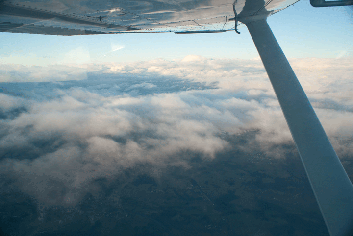
At Midhurst he continues and we turn for Seaford, then coast out and switch to Farnborough East as requested and climb through some light clouds to 4,500ft and VMC on top. Over the sea it's smooth and calm.
Change to London Info, then just before the FIR boundary (to stay legal) we descend through intermittent clouds and hug the base (I like to be high over water), changing to Le Touquet who offer us a left hand circuit for runway 32 which is weird as they normally do all circuits over the forest, not over the town. They also have traffic on a right hand circuit, which is a bit of a mistake as by the time me and the Dutchman in his PA28 are on Base leg we can see each other. We speed up, he slows down and I'll to expedite my runway vacation so he can land after me.
We get a bit of a wiggle over the dyke 200ft up, then we're over the threshold at 60Kts with full flap and flaring. Nice arrival, keep the speed up, then exit first left listening to the Dutchman dropping on behind us.
Simon is impressed by my professionalism, which is pleasant. You can fool some of the people some of the time!
I love Le Touquet: they are so laid-back. Within 90 seconds of walking in to the terminal we are out the other side with bicycles, which is part o the attraction of travelling by GA.
After a bicycle tour of Le Touquet, a walk along the beach and a damned good French lunch we cycle back to the terminal, drop the bikes, pay our very reasonable landing fee, file a flight plan via the quirky French PC (try getting a "_" out of a French keyboard... I have my laptop and my iPhone does a mean hotspot but everything's in the plane, so this is marginally easier...) and call for start.

|
|
|---|---|
|
|
Taxy out, wait for ages for a PA28 doing power checks and (I reckon) his make-up, watch a C172 on approach have a serious wiggle over the dyke, line up and take off straight out on runway 32. As we rise above the dyke we get a bit of wiggle: I reckon that would have been "sporty" in a C42!
Lydd is straight on, so we need do nothing but climb, change frequencies and stick the autopilot on. The clouds have cleared and it's smooth at 4,500ft.
Coasting in at Lydd we cruise-descend to slot in below the London TMA, divert slightly to avoid parachuting at Headcorn, then again to avoid Biggin Hill's ATZ, and follow the M25 West towards Blackbushe. It's quite bumpy and hazy at 2,300ft: I'd prefer to be higher but we can't here. Join deadside for 06 at Blackbushe and slide down the approach.
Typically, I choose today to flare a mite high and bang it on the runway with a bit of a bump. Bugger.
Still, Simon's happy and wants me to take his son, my Godson, out. So I didn't scare him stupid: phew...
After a cup of tea I say goodbye to Simon, fire up once more and trundle off home. The bumps have smoothed out as they always do after 4.00pm (useful tip that: if you're faced with a runway out of crosswind limit wait till after 4.00pm to tackle it - the wind will have dropped a lot) and it's but a short hop over Reading and Greenham Common back to CPT and Didcot power station where I swap from Farnborough, get the ATIS from Oxford and request a Right Base join VFR for 01, keep the speed up at 130Kts all the way to the Pear Tree roundabout, then throttle back, slow the plane and slide down Right Base then Final, round out and land neatly, taxy in and shut down.
It's time to really clear out the plane, empty the bins, tie it down and pop the cover on.
Dinard - Avignon - Carpentras - Limoges Dec 12
My 50th birthday is in early December, and the Management comes up with a Birthday celebration idea: she was at school with Jo Fleming who now runs Chateau Unang in Provence. Why don't we fly down and stay in a luxury Chateau hotel nearby, see something of her and of Provence and celebrate my 50th? It's either that or have a big party here and watch everyone drink my booze.
Nah, no contest...
Frantic weather planning ensues and we end up with a neat two stage journey, passing North of London and breaking in Troyes in North East France for lunch, then flying down the Rhone valley to Carpentras where there is a small local airfield within 3 miles of our destination.
French airfields work on a completely different assumption to UK airfields: in the UK an airfield is only open during published hours and you often have to ask permission to land there (known as PPR or "Prior Permission Required"). In France the opposite is true: and airfield is assumed to be open all the time unless NOTAM'd otherwise. There may be no one in the Tower to help you but the airfield is still open, and if they can't be bothered to be there to collect your tax d'atterisage (Landing Fee) well, that's their fault.
However Carpentras have no lights and being December the days are short, so we may run out of light and have to divert to Avignon nearby: not a problem coming back to Oxford which has lights and is open until 10.30pm, though.
We have a route, a destination and a timeframe: 6 days in the first quarter of December. Weather will play a big part in the execution of the flight: no one wants to be flying in icy clouds and the UK IMC is invalid in France. However, French rules allow Visual flying "on top" of the clouds (and actually ATC can't see whether you're in cloud or not: they're usually 50 miles away in a warm office with coffee....).
So we do have a fair amount of leeway, and also if we have to delay it's not a big issue: this is a holiday, not a scheduled airline after all.
Surprisingly, as the departure date nears, the winter weather begins to play ball: we have a front half way down France we can fly over and the remainder is scattered or broken with light winds.
By the night before departure all is planned and ready...
We wake up early to radio reports of snow, snow everywhere: the outside lane of the M40 is blocked by snow; every METAR East of Oxford is awful and Troyes is forecast to be snow all day.
We're stuck.
However, a quick call to my weather guru suggests the weather may be better down the West side of France via Limoges and Carcassone. We have to visit a Customs airfield in France on entry (and exit) and these have been recvently pruned by the French Government, but once in France we are free to go wherever we like, so we plan a route to Dinard at the base of the Cherbourg peninsula near St Malo, then we will feel our way across France.
I love this moment at the start of each flight: you know the day will test you in ways you cannot even imagine, but therein lies the challenge: to be flexible, safety-conscious and assertive but not bold.
At the airfield there is, surprisingly, bright blue skies and no snow; we file a flight plan via AFPex (which goes immediately in to the system) to Dinard, pop our lifejackets on and leave.
Immediately two minor niggles appear: the cigar lighter socket doesn't work, so all the GPS units are running on batteries which won't last for ever; and the batteries on my ANR headset are dead (but we have spares).

By Kingsclere clouds are appearing and by Portsmouth, as we route around the Solent Zone, we are VMC on top at 4,000ft.
There is a preferred cross-channel VFR route leading from the Southern tip of the Isle of Wight straight across to Cherbourg. The CAA would prefer us to fly this route so if we ditch they know where to look for us, however in a classic case of the left hand not knowing what the right hand is doing, this route takes you slap bang through a Military Firing Range: very clever....
The protocol is that you request the status of the marked Danger Area and it is either "Inactive" and you just carry on through, "Active" and you contact Plymouth Military and request a Danger Area Crossing Service, or "Active and in use" in which case you don't cross unless you want a Naval shell through the wings. Not ideal....
In this case it's Active but Plymouth Military are happy to provide a crossing service and we never even see the channel as we cruise along, warm and happy at 4,000ft.
As the French coast approaches we cross the International Boundary and change to Brest ATC who pass us to Cherbourg who allow us a Transit through their zone, then as we go feet-dry the clouds break and we cruise down the Cherbourg peninsula in clearing weather.

Dinard report showers and strong winds in their vicinity; as we approach we can see a nasty squall crossing the field, so we orbit a couple of times in the sunshine then head in as the squall passes. The wind is straight down runway 35 and we flare for what must be the smoothest landing I have ever made in the middle of the huge runway, and taxy in for fuel.
Dinard is completely deserted and the pumps require the assistance of the Fire personnel who are in a shed at the opposite end of the apron, so we get the key from them and trundle back while Nessa goes in search of a loo in the terminal.
The pump instructions are only in French (quelle surprise!) so I bless my school French teachers who bashed just enough French in to me at school to understand the instructions. For reference, the secret is to zero the pump counter, then the motor starts.
A large amount of fuel later Nessa still hasn't appeared but as I walk back past the terminal a pair of arms is waving at me from inside. On closer inspection it's Nessa who has become trapped in the terminal by the security lady who won't let her out unless I can confirm she is my wife and is meant to be on board the aircraft with me.
Tempting, but in the end I have to relent and they let her out, we pay for the fuel and the Tax d'aterissage, and decide to head directly for Carcassone, which is at the South end of the Massif Centrale, the range of hills crossing France from NE to South. The plan is to slip under the weather there and head round to Avignon. If we struggle we will still have fuel to overnight in Carcassone or come back to Limoges.
 The weather is broken clouds and very smooth as we head South, being passed between relaxed French controllers who all speak English. An hour later the weather is so good we decide to try for Avignon instead, so replot on the GPS and turn more South East.
In the UK you can rarely fly above 5,000ft as there are so many Airways above that and we don't think in terms of climbing above weather: this is a mindset that does not apply in France where VMC on top for everyone, not just those with Instrument Ratings, is allowed and the country is sparsely populated.
As the country rises around Aubusson we climb to 4,000ft and then we see the clouds thickening and becoming overcast. We may have to divert to Carcassone after all.
Near Aubusson we are finally facing a solid wall of icy cloud topping out at what looks like 6,500ft. At this point we are under a 4,200ft height restriction under an Active Restricted Zone, so we turn back for a little thought. Some map perusal discloses a route 20 miles to the South where we can climb to FL85 and soon after even higher, so we notify ATC and divert around the edge of the Restricted Zones remaining VMC as the scattered clouds tower above us. 10 minutes later we can turn sharp left and climb to FL85 - suddenly we are on top of an unbroken layer and it's very smooth. We're only 20 miles off course so can reconverge on our original Avignon course.
The cloud tops slowly climb up to meet us until we are occasionally scudding through bits of cloud, which ice up our windscreen and stiffen up the trims. We don't want to stay in there. A bit of left and right around some of the taller stacks gets us finally to the end of the Restricted Zone and we can climb to the limits of the aircraft.
We climb to FL95 then FL100 which is where the climb performance of the aircraft becomes a little restricted, but the clouds are now well below us. This is a much better way of coping with weather. I wouldn't want to stay much above FL100 without oxygen, but it's not like we're running marathons up here: more like sitting in a warm cabin eating Alpen bars because the restaurant at Dinard was closed. Occasional holes in the clouds reveal high, snowy, rocky ground below: not a good engine failure scenario.
 We have a 50Kt tailwind so we're seeing ground speeds of 165-170Kts and the clouds ahead are slowly going down so we should be OK, although we are starting to see the sun sinking and as Carpentras have no lights we may divert in to Avignon, who do have lights.
70 miles from Avignon the clouds suddenly stop and we're flying over clear ground, taking to Orange control who clear us to descend direct to Avignon. Frustratingly, if we had gone direct from Dinard it would have shaved half an hour off the journey and we would have had more light to play with - as it is I make the "non bold" decision to land at Avignon. We join Downwind left hand for runway 35, turn over the river and drop gently on to the windless runway, turn off and park up.
We've arrived. And our drinking bottles are all squished up with the pressure.
In fact there is plenty of light and we could have gone to Carpentras but just occasionally discretion is the better part of valour. We can always move it tomorrow.
 So that's a few records broken: longest flight (3hrs 40 mins), first internal French flight and highest flight (by a very long way). It's all good envelope-stretching stuff.
It's 24 hours later and the Mistral has been blowing at 60Kts all day (there's a good reason all the runways in Provence are oriented North-South) but the guys at Carpentras reckon it will calm down around 4.00pm so we borrow a Carpentras resident who is an Alouette helicopter pilot with 3100hrs and not a single word of English to give us a hand and head off for Avignon airport once more in our rented diesel Twingo.
He smooths the way through the procedures at Avignon (€34 for landing and a night's parking) until we meet an officious woman Security officer at the main gate who demands passport, pilot's licence etc etc before simply abandoning us to the entire apron. Oh well, she's only doing her job.
The Mistral has not budged Tango Golf despite having nothing to tie it down to the previous night, so we pre-flight and start up. There is still 20 Gallons on board and Carpentras is 10 mins away so we'll be OK for fuel.
With the mad Frenchman talking nineteen to the dozen from the other side of the cabin plus badly-accented ATC the intercom is all pandemonium. Plus he is making random stabs at the rudder as we taxy, drawing flap retraction diagrams on a pad of paper and trying to get me to do power-checks on the stand in front of a non-tied down Partenavia P68 who I'm sure would really enjoy being blown about....
Trying not to get too distracted I taxy, power check and line-up. Take off is smooth until we hit 500ft at which point it gets a bit rough, and we head off for Carpentras which hoves in to view 5 minutes later. We join Downwind ("vent arrière") for 31, turn base ("Base") then Final ("Finale") and yes, the wind has dropped so we can drop on fast with only 10° flap and roll out, backtrack, exit the runway ("Piste dégagée") and taxy in to park behind the trees for some wind protection.
That wasn't so hard.
We've had 5 days of wonderful food, great wine, sightseeing and comfortable hotels, but now, sadly, we must return home.
There is a weather system over central France clearing slowly to the South, very similar to last week's weather, so we'll do broadly the same journey in reverse but this time we will stop in Limoges where they have a better restaurant.
There is a big French military exercise using all the restricted Zones over the Massif Central so we have to go South towards Carcassone to stay clear then loop around to head North West, which is OK but now we have a punishing headwind. We can drop down the other side at Limoges, Poitiers or if it's really bad, at La Rochelle.
It's beautifully clear and wind-free as we extract TG from the trees, push it over to the pumps and fuel-up: we'll need all that Avgas.
Today there is no Mistral: it's quiet, early and very cold. We scrape the ice off the wings (the 50L of de-icer I have bought is sitting waiting for me at home having arrived too late for this trip!), pack the Christmas shopping bags and us in, and take off, flying around to Chateau Unang first for pictures (where it's very gusty), then departing West in bright sunshine. We can see the Med glinting off to our left.
 Orange clear us to 6,500ft and the bank of cloud that is the front slowly nears us. At 6,500ft we are only just above the clouds and with a ground speed now of only 86Kts it takes ages to reach the end of the Restricted Zone at which point we can finally climb to FL85, well above the weather and in the blue sky again.
We have to divert 20 miles to the South West to avoid a big NOTAM'd Restricted Zone due to the military exercise. As we finish skirting around the edge and rejoin our original course the controller calls us to tell us the exercise is now over. Typical! I laugh out loud and forget that the transmit switch is still pressed, which elicits a curt response: "well, Tango Golf, I'm glad you found 'zat amusing".
The temptation to quote " 'Allo 'Allo " and say "I will say 'zis only once" is very strong.....
As we plug NW we discuss whether Limoges or Poitiers is the best lunch stop, and when Rodez control passes us on to Limoges we ask for a weather check. At present they continue to be fogged-in, so we decide "Poitiers" but a few minutes later their cloud begins to break and they tell us they are now marginal VFR.
 I can see the ground through a hole, so we spiral all the way down to 1,000ft and point towards the field, at which point we are visual with the ground but not with the airport, until it suddenly appears and we call 4 mile Final for 03 and plop on to the long, wet runway in clearing weather for lunch and fuel.
Of course this being France everyone is at lunch, so we join in and head for the terminal where we are shepherded through Security and the waiting RyanAir queue to the office where we have to pay.... all of €5.13 Landing Fee.
I like flying in France.
A couple of differences are evident, compared with flying in the UK:
The Transition Altitude (where you change from flying on an often incorrect barometric pressure relative to either the local ground: QFE; or the Mean Sea Level: QNH, to an International Standard of 1013.25 HectoPascals [29.92" of Mercury in America]) is 5,000ft, whereas in the UK it was 3,000ft and is now 6,000ft. From my researches it seems to be 5,000ft all over Europe, so typically the UK is once more out of step (also see electrical plugs, which side of the road to drive on, and digital radio standards, but I digress).
 In the UK a request to ATC for a "Basic" or "Flight Information" service usually meets with an immediate request to "pass your message" or "tell them about yourselves" at which point there is a standard list of information you pass. However in France the request is usually answered with a squawk setting and only once they know where you are do they ask for your details, which is easier becasue they already know where you are, how high you are and in what direction you are heading, so you don't have to woffle on about it. Aircraft type, PoB, source and destination are all they need, which reduces the time spent on the radio drastically. A Wise Idea.
Having fuelled both ourselves and the aircraft, filed a flightplan in the Aero Club and checked the weather (CAVOK all the way to Oxford) and (we discover much later) leave my iPhone on the bar, we start up and ask for taxy.
The controller has had too much lunch: he warns us first of the Military exercise which is a) South of us and b) over, according to Rodez, then he has no record of our flight plan (which I know I filed 20 mins before).
So we shut down and wait.
And wait.
At length we ask Tower if they have our Flight Plan: Oh yes, they have. They just haven't bothered to tell us.
 So we start up, taxy to the end of the runway and depart, climbing to 3,000ft in the afternoon sunshine. France is beautiful to fly over: villages, fields and rivers pass slowly: ah, we still have a headwind. Although we are now at least making 115Kts over the ground France is a big country and it will take us 3½hrs to get home.
Eventually a layer of broken clouds appear and we climb to 5,000ft on top where it is smoother (I've got in to the swing of being on top now) and grind North towards the Channel.
By the time we finally do reach the coast the light is fading, so all the lights go On. At this point we have had issues with the Low Voltage light coming on but no, it's fine, and the ammeter is charging.
We ask for the status of Danger Area D036 once more, but the French Controllers want us to speak to London Info, who promptly tell us that the Danger Area is Active with Live Firing to 23,000ft.
"London Info, Wait One"....
 We have three options: request a Special VFR Transit of the Airway to the West of the DZ, drop to below 3,500ft and fly below the Airway, or there is a narrow corridor to the West between the DZ and the Airway. That works for us.
So now we're about to cross the Channel at night, in December, in a single-engined aircraft, off the main VFR route. This is somewhat outside even my comfort zone, even if there is a ferry we can ditch in front of and at 5,000ft can glide quite a long way.
It's nail-biting time as we head out over the dark water, first North West then North East as we clear the edge of the DZ. Engine T's & P's get a lot of checking, but slowly the lights of Southampton appear and before long we are within gliding distance of something solid, so swap to Solent and ask for a SAM Transit. Phew....
Solent ask us if we can accept an IFR Transit: well, yes we damned well can now we're back in Good Old Blighty. Re-check the VOR ID, ensure we are absolutely spot on 5000ft and fly in.
Solent spit us out heading for Compton, we descend to 4000ft and we can see Oxford in the distance. Just got to get home now.
Join Right Base for 01, turn Final and turn the landing light on, which does trigger the Low Voltage Light (well I don't care now...), descend and flare, touch down with a bit of a bump, and we've Done It.
We have proven that flying to the South of France in a Cessna 182 is not hard, but needs careful planning and a smattering of French.
I reckon I have used just about every bit of training I have had (well done Oxford!) and it has, as I expected, tested me in ways I couldn't have imagined when first planning it.
We certainly did use the free WiFi in the hotel to massive advantage and the Green/amber/red VFR/marginal/IFR lights in SkyDemon, both on the PC and on the Ipad are fantastic, the iPad is a really good back-up GPS and the battery lasts a long time if you turn the brightness down.
Meteo France is very good weather site and the French AIP gives daily AZBA (low level route) maps.
But what will I do differently the next time?
The flight down, with tailwind but also with a Southerly kink, took 5hrs 40 mins.
The flight back, with headwind and a more Southerly kink, took 7hrs 5 mins.
We should have planned a more direct route: Oxford to Avignon is 4hrs 15 with a bit of tailwind which is just within the fuel range of the aircraft but leaves no reserves, so realistically you want to break it in the middle at around Orleans or similar.
Knowing the weather was bad over the centre of the country we should simply have planned to fly over the top of it at FL100 or even higher, which with a bit of careful planning is entirely possible: you just need to plan your half way point to be "VFR" for the approach, kind of....
This trip has revolutionised my flight planning thinking: in Europe it is possible to get on top of the weather and although it does make the journey less interesting at elast you actually get there...
Fuel consumption turned out to be 13 US Gallons per hour, which is spot-on book value. The aircraft has 74 usable US Gallons of fuel on board, so has a range of 5.69hrs: more than my bladder.
A word on navigation equipment. We used 3 separate GPS units:
- A Garmin 296 with external aerial attached to the windscreen (it won't work any more with the stub aerial and is temperamental about starting up now it's a few years old)
- An iPad running SkyDemon software, using the iPad's internal GPS aerial
- An Aware box with French maps loaded
 We had a 1:100,000 French paper map with our route on it as well. We had VORs marked on the chart and did a cross-check every 50-100 miles. We could have VOR-crawled but frankly life is too short and this is 2012: GPS tools are simply better. We could have got home on VORs alone if necessary had all the GPS boxes failed, but actually (don't shout too loud) they're not that accurate....
Visual nav: map and stopwatch? All French towns look the same: some have rivers and some don't; we were VMC on top a lot of the time so couldn't see, and turn-time-distance with a 50Kt quartering tailwind that varied with height? We could have been in Germany, Italy or Spain for all we would have known...
SkyDemon on the iPad was undoubtedly the star of the show: we generated routes and vertical profiles in SkyDemon on the PC, saved them "to cloud" and loaded them "from cloud" on the iPad. Ensuring we had already "found plates" on the iPad before departure via WiFi allowed us to access the plates en route. We had all the expected airfield plates printed out but Poitiers we only had on the iPad.
Being tight, we "generated" the flight plan in SkyDemon then copied and pasted the route in to AFPex, which we preloaded and stored before needing to file. We filed at Oxford via my laptop and Ops' WiFi and at Limoges via the Aero Club PC. AFPex is free, whereas SkyDemon charge for flight plans.
We also had an iPhone with data roaming turned on and Hot Spot mode available for if there was no WiFi for AFPex or the SIM-less iPad.
We found it was simplest to check the weather via SkyDemon on the iPad, because it gave you a simple green/amber/red airfield-by-airfield weather report that could be drilled down in to, and also for height planning it shows the traffic zones (green for anything not requiring a IR) and Restricted Zones (red). This makes flight-planning accurate and easy.
We then loaded the routes "to cloud", opened them "from cloud" on the laptop then exported them to the Garmin via USB.
You then press the "Go Flying" button and for £80 a year it does everything the £850 Garmin 296 does, but with a bigger screen. The iPad will also go literally all day on its internal battery provided you turn the brightness down a fair amount (it's still very readable).
It will even, staggeringly, provide georeferenced airfield plates and the compass rose at the bottom pulls out to be a working HSI. Tea-making facilities are promised in the next release and shaking the iPad I am convinced produces a faint but distinct sound of rattling Kitchen Sink...
The only issue we had was that SkyDemon runs on Zulu time whereas the clock on the top of the iPad shows local time. This confused me for a while on the return journey until I realised.
I have had issues before with the internal GPS aerial dropping out but this time it worked absolutely flawlessly the entire time.
Considering Tim Dawson was dead against writing SkyDemon for the iPad at one point (when we exchanged e-mails he was set on a bespoke tablet) they have made a damned good job of it.
The Aware box worked well but has limited route planning ability and the battery lasts only an hour or so. Still: it's a great backup.
Caen - Cholet - Caen Dec 13
Alice's boyfriend Kieran's parents have a chateau near Nantes. This sounds grand, but in fact they rent it out and they live in Oxford, so it needs more garden maintenance than it actually gets. We have offered to go and deliver a strimmer, attack the overgrown gardens with that and a chainsaw, and do some DIY at the same time.
You aren't going to get on a commercial flight with a chainsaw and a strimmer, but flying privately means circumventing a lot of the pettiness of commercial aviation (and all the waiting around!), so in early December with the weather bright and sunny we load up the plane at Oxford with tools, gardening clothes, chainsaw and strimmer, which only just fits in the baggage door. We do get some strange looks at Ops as we march through, though... Lifejackets and PLBs on, liferaft at the ready and we're good to go.
 The bowser loads us up with full fuel as the sun rises and we take off to the South. The world is beautiful this morning, the rush hour traffic snarls up satisfactorily beneath us on the A34 but we have a tailwind and 30 minutes and a Solent Zone Transit later we're over the Channel and it's cloudless and smooth.
In a reversal of the norm, the French Coast at Cherbourg is cloudy, and we both remark that it is strange we think of them as "French" clouds, given that they were probably over England yesterday.
Coasting in for the Mike Papa beacon we are suddenly bumpy VMC on top and never even see the Cherbourg peninsula until we have turned South East for Caen and the clouds break again over the sea. We descend through a gap so we are below the now-scattered clouds and approach Caen for a downwind join for 31.
As we descend on Final we get some gusts from somewhere and it all goes a bit weird at about 100ft before settling down. Still, my unbreakable Zen concentration on the end of the runway results in a barely detectable arrival, so this must be the way forward. A fast taxy on to a stand in the middle of the huge, nearly empty apron and we can shut down. 1hr 15 mins from Oxford: Not bad.
This stop is nominally for Immigration purposes (not that the French care) so we can pay our €4.80 in the nice, warm, friendly office and get immediately off again, but the Tower seems to think we need a Flight Plan. This is an internal French flight for which we do not need a Flight Plan adnd he eventually relents, but I think he is more used to English people flying to Caen then turning round and going home again. Even with this delay, we are still back in the air in 30 mins - we will use Caen again.
The run from Caen LFRK to Cholet LFOU is a straight line and should take 1hr, so we climb to 3,000ft, talk to Deauville who suggest Brest who suggest Rennes, but we can't raise Rennes for 20 minutes or so until we are over some low hills and into racehorse country. Rennes pass us eventually to Nantes and after getting rained on for a couple of minutes the skies clear and we start our descent over the Loire for Cholet.
 At this point we decide to depart from our course to take some pictures of the chateau, but on turning to where we think it is we can't see it. It turns out it is further West than we originally tbought, so loop around for a few minutes before finding it.... slap bang under one of the AZBA low level routes. Ah, but I thought that might happen so this morning I checked the AZBA website and during this period no fast jets are using it, so we are OK.
Once we have taken some low-level shots we return to the airfield where the Tower guys have now gone home as it's lunchtime (and in France lunch is taken very seriously indeed). I have a laminated set of French language circuit calls and call vent-arriere (downwind), turn Base then Finale (Final) what seems very low over Cholet, drop down for a smooth arrival, then Piste degagee (runway vacated) before guessing at a parking place and shutting down in the bright warm sunshine for lunch.
 Whilst having lunch at the excellent restaurant overlooking the runway (why on earth do airfields like Oxford and Denham have restaurants where you cant see the planes?) we watch a PA28-180 doing circuits: he spends an awful long time on the runway and his climb out rate is embarrassingly low. I think we can do a better take-off....
Cholet have pilot-operated lights, so at some point we will have to try this. Apparently it's 3 clicks for On (15 minutes) and 7 clicks for Off. Next time....
4 days later we are ready to go home: the plane has been de-iced via our handy new pump-up de-ice sprayer, fuelled, packed with Christmas booze and presents but no strimmer: that's been left at the chateau.
 The weather is once more bright sunshine so we start up, taxy out to Bravo, backtrack and treat the restaurant guests to a Cessna 182 short-field take-off: 20° flap, rotate at 58Kts and we're at 500ft before the end of the runway. That's how to do it!
We turn North and climb to 3,000ft, swap to Nantes, then Rennes (2 separate frequencies for some reason), then Brest and finally Caen where they ask us to expedite our descent as they have aerobatics above 2,000ft. I can do that: Prop up, power back, nose down and we have a descent rate of 1700ft per minute before turning Downwind right hand for 13, turning Final and trying a new experiment. I want to see how long I can keep the nosewheel off the ground for after landing. We land smoothly and I just keep pulling, the nose staying in the air down to about 40Kts before we let it down gently, slow and backtrack. Interesting.
We taxy in and shut down on the completely empty apron before asking the Tower if they have our Flight Plan for 30 minutes hence (which they have). It can take 60-90 minutes for a UK AFPEx-generated Flight Plan to arrive in France, so my 8.00am raising prevented any problems.
Our miniscule landing fee paid, we strap on lifejackets and start up. Despite starting a little early we actually roll down the runway exactly on our Flight Plan time which is very satisfying, depart North East and climb with Deauville to 4,000ft for the run to the Mike Papa beacon at Cherbourg, flying over the remains of the Mulberry Harbour at Arromanches. Once there we turn North, coast out and switch to London Info who are uninterested as we need a DACS for the mid-Channel Ranges.
 Last time we came this way we had to go around but this time the ranges are quiescent so a very helpful and perky Plymouth Military shepherd us across. It's so clear we can see both the White Cliffs at the end of the Isle of Wight in front of us and the French coast behind. It really is not that far, but far enough when considering engine failure. I'm glad we're doing this in the daylight, and any coughing or weird noises will see me heading for a mid-sized ship and a landing half a mile ahead in plain sight!
But no, soon we are over the Isle of Wight as the sun sinks and then a VFR transit over Southampton while watching an Embraer jet turning to capture the Localiser for 20, then head for Compton, turn for Oxford, swap to Oxford and cruise-descend for a visual join for 19.
A BeechJet is behind us and as we line up for downwind, even at 140Kts in the descent he overhauls us easily as we orbit for spacing then remember to turn the landing light on (there's a first, then...), drop down the approach, flare and touch smoothly 2 minutes in to Official Night. Wheel all our Chritsmas shopping out through Ops on one of their trolleys, and give them a huge box of Christmas choccies: they've been brilliantly helpful this year.
Early December can be a lovely time to fly: it's often cold but bright and France is just too convenient to ignore for Christmas shopping.
What did we do wrong? Well, apart from failing (on reflection, after our return) to carry plates for the alternate airfields quoted on our flight plans (doh!), not a lot. Everything went as planned, nothing broke and a good time was had by all. Oh, and we proved that carrying a strimmer by air is easier than it might appear.
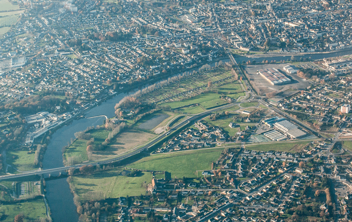
|

|
|---|---|
Le Mans, Bordeaux and Limoges 7 May 2019
Last year was a Scottish year. This year will be a French year, it seems.
I hold an IR(R) Rating which allows me to swan about in the clouds within the UK but not fly in IFR Airways or fly in clouds in Europe.
I’ve always been a bit mystified about this, but told that because of the absolute need to fly IFR accurately and because of the differing nature of clouds outside the UK the expertise involved in holding an IR(R) is insufficient and you need a full IR to perform these superhuman feats: 13 exams, 100 hours of additional training and a Class 1 Medical.
I’ve never quite been convinced, but there you are....
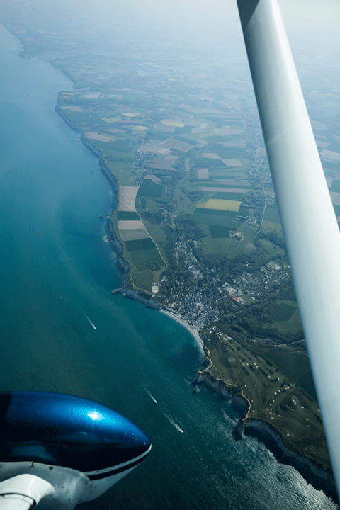 Today Nessa and I are flying to France with my colleague Steve and his wife. Steve is ex-BA and has more IFR experience than I could possibly ever accumulate so today we can file one of these magical IFR Flight Plans and climb to the dizzy heights of 9000ft.
For the 1st leg to Le Mans he’ll do the radio and I’ll fly. Let’s see how hard this actually is.....
We’ve already loaded our flight plan in to the Garmin 430W and SkyDemon so have plenty of options for Nav. Steve has filed IFR for BAMBO then KENET and other random letter combinations all the way to Le Mans so we call for start.
I would have filed "Direct CPT Direct SAM" but due to Compton congestion the normal routing is apparently via BAMBO (more or less directly overhead the fire service training school at Moreton-in-the-marsh further West), before we head South via KENET.
We wait longer than normal at the Charlie Hold for them to coordinate our departure with London and Brize but are eventually cleared for take off direct BAMBO.
Take off is as normal, but despite being VMC I’ll conduct the flight as if we were in cloud from 300ft, so on to instruments and turn on track. Apparently I need to be within 10 degrees of track and 100ft of height, which isn’t actually all that hard even without the autopilot and Altitude Hold....
Within a couple of minutes we are re-vectored left straight through the Brize Zone: ooh, never flown this way before.
IFR seems to consist of vectoring and level changes and Direct To commands, nothing I can’t handle. Select the waypoint required, hit "Direct To" and "Ent" twice.
At 6000ft we swap to 1013Hpa and settle in to the cruise at FL080.
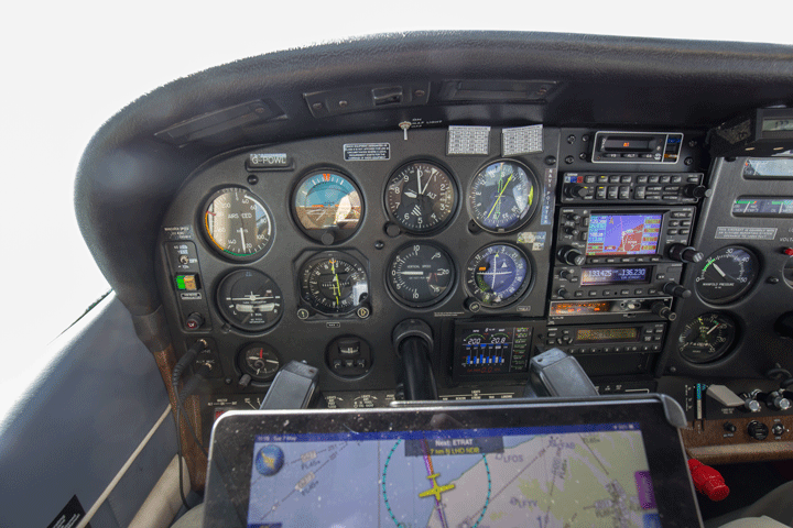
From then on it’s straight and level all the way over the channel to Le Havre, turn and head for Le Mans. English controllers give way to French controllers who are chopping between heavily-accented English and rapid-fire French.
Only the French exercise their right to conduct their ATC conversations in their local language, the remainder of the world has standardised on English....
I am just surprised at this rarefied level of aviation communications (basically it’s us, BA and EasyJet) any French is to be found but once beyond Paris we find ourselves talking to the same controllers we would be with if we were VFR. The radio is, if anything, easier than VFR....
As we approach Le Mans we are given a Direct to the MAPEB Hold South West of the airport preparatory to the RNAV approach for R21, which is a nuisance as it is past the airport in the wrong direction, but half way there and surprisingly close to the airport that gets instantly converted in to “join Downwind right hand for 21”, giving us very little time indeed to turn hard left (grumbles from the back), lose 3,000ft and call vaguely Downwind before turning Base over the railway yards.
Turning Final over a housing estate we float down to a poor landing in which I play my old trick of pushing the wrong rudder pedal to straighten the aircraft as we touch, but in the end it’s safe and we exit to the pumps for Douanes and sandwiches in the terminal.
 One of the disadvantages of filing flight plans is that you can’t leave until the flight plan is current, so we hang around for 75 minutes. I would have simply cancelled the 2nd leg plan and departed VFR without a flight plan but I suppose Bordeaux might have had a problem with that, I don’t know.
Like America, French airfields are marvellous at mixing commercial and private aviation, so I suspect it would simply not have been an issue.
Steve has evolved a neat trick for dipping the tanks without getting the ladder out by hooking his hand in the door frame then putting a foot on the strut. I try it, but I keep thinking I’m going to slide off backwards!
Somewhere along the line of our fuel calculations and pump request we miscalculate and end up with 10USG more than we should have. We are now over MTOW.
Moral dilemma; should we vent 10USG back on to the tarmac, attempt to get the pompeurs to remove 10USG or fly? Steve and I go into a huddle....
Eventually we conclude we’re both experienced enough to know that this aircraft will fly a little overweight, we have a nice long runway at our disposal and it is neither especially hot nor high, so today we will Break The Rules.
 In practice our take-off is entirely uneventful and in fact surprisingly short, Steve climbs straight out and back up to the Airways and we’re back down to MTOW within 40 minutes or so.
The ground becomes sandier as we approach Bordeaux and we pass through a couple of small showers.
Bordeaux being a big airport give us the RNAV approach for R11 and we descend to the Initial Approach Fix, then turn, establish the Localiser then the glide slope and descend just like in the UK.
As Steve pops it on the ground neatly I’m thinking “what was more difficult about that than a UK RNAV approach?”.
I accept the conditions were VFR and there were no strong winds but if you’re competent with a Garmin 430W and you have an IR(R) and some recent experience you’re capable of performing a European RNAV approach.
You’re just not allowed to.
This is a classic example (and there are many) of aviation bollocks: over gilding the rules in search of greater perceived safety.
There is a competency-based European-wide En Route Rating available now but that doesn’t allow you to do RNAV approaches, so what’s the point?
 The CAA have bent over backwards to continue to provide the IR(R) because evidence shows IR(R) pilots simply don’t fly in to terrain.
At all.
Even in clouds.
But Europe doesn’t want it, because it wasn’t invented there.
It’s this sort of administrative stupidity that has the UK throwing up its arms in frustration at the EU.
You could point to it as a classic example of why we voted to leave: it’s a nonsensical and hugely expensive rule that the UK is exempt from, so why should we continue to fund it?
The EU (over and above the original EEC free trade agreement) has signally failed to provide any real economic benefit for the UK (cultural benefits yes, and that is a separate argument) so many in the UK feel we are getting a poor economic deal (our outgoings exceed our incomings) and no concomitant reduction in inter-country bollocks like this.
If the EU wishes to retain Britain (as M Barnier maintains) then they need to move swiftly and decisively towards reversing many of these nonsensical rules (and we need to learn not to gold-plate them).
Mandatory handling at Bordeaux consists of an (expensive) man with a van greeting us at the parking slot; Steve and I decide we have sufficient fuel with 1 hours reserve to make Limoges without refuelling so they jump out and Ness and I fire up for an immediate VFR departure for Limoges.
The GA apron is right next to the hold for runway 23 which they have changed to, the wind having swung round, and I can spot an EasyJet 737 coming up the main taxiway so to avoid any wake turbulence issues we whizz out to the hold, call ready for an immediate departure and roll while the controller is still talking. We all know they want me out of the way of the big stuff as quickly as possible.....
 Airborne, left turn and we’re cleared to exit via the VRP “SE” which I can see on my amazing geo-located approach/departure chart in SkyDemon.
You have got to love SkyDemon: it just keeps getting better and better.
Half way to Limoges they clear us to switch to “La Rochelle Approach” which seems a bit extreme given the direction in which we are travelling, but hey ho... it turns out the frequency they give us is Limoges Approach so that’s fine and Limoges ask us to report airfield in sight for a downwind right hand join for 23.
Limoges is surprisingly high: I descend from our cruising height of 3000ft and by the time we are at 2000ft QNH I reckon we need descend no further for Downwind.
We are number 2 to a Robin in Base leg and I am damned if I can see him, so we’ll extend downwind and slow down.
He eventually appears on short final so I can turn base, then slow.....right....down to ensure we don’t overhaul him.
As he finally crawls off the runway we can call very short final indeed, get cleared and drop on all in a couple of seconds. Honestly, he could have kept his speed up......
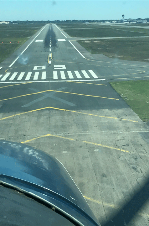 We exit the runway and taxy off to Lima parking where for some unknown Gallic reason the parking slot numbers are between the actual slots. So which side of the markings is the correct yellow line to follow? Against Nessa’s advice I park up on the actual numbers and shut down, at which point the tower tell me I am not in the correct place. Damn: my wife was right! I’ll never live it down.....
A week later we're back at a very windy Limoges. The ATIS is giving 06022G30KT and outside the aircraft is bouncing around. Just as well I put the control locks in.
Our Air BP card now shows itself to be very useful indeed as the options are to call up and wait for a Pompeur to come and fill us up and take credit card payment (I'm sure it's lunchtime as well...), or pull WL over to the pumps (it's downhill) with the towbar and stick the card in the dispenser. The card works first time with no PIN number, the pump starts and a carefully-calculated 200L goes in, 100L per side, to give us 50-55USG at Bordeaux.
Afterwards, pull the aircraft forwards to clear the pumps then A check, load the bags willy-nilly and call for start. I've done a VFR Flight PLan so everyone knows when and where we'll be, and after a brief warm-up we are cleared to taxi to Sierra. Taxying is very bumpy and we go slowly: I am not having any funny stuff going on. Warm up at the Hold and call ready, SPLAT-check and roll with some in to wind aileron. Take-off is a non-event and we turn South West for Bordeaux, heads bouncing off the ceiling with the tailwind.
It remains bouncy all the way to Bordeaux until we drop below 2,000ft under their Zone when it just stops, and we are cleared to VRP SE then SA and a Right Base Join for 08, the wind given as 06008KT. How can it be so calm here?
Every pilot chases the perfect landing. Some of mine are good and some aren't. Today is perfection, I just don't feel the wheels touch. Taxy in and meet Steve for more expensive Bordeaux hospitality.
We agree Steve will fly us home because I flew 2 legs coming out, so he files IFR and we go home via a windy Guernsey and Direct CPT (I thought they avoided this?) before opting for a visual recovery for Oxford which has 07008KT meaning a small tailwind component.
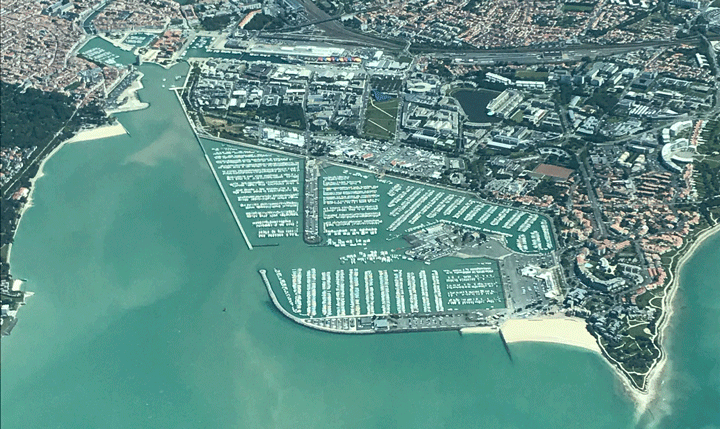
|
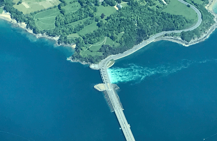
|
|---|---|
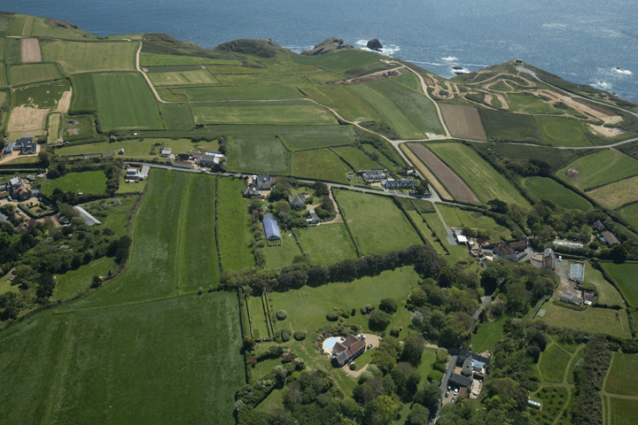
|
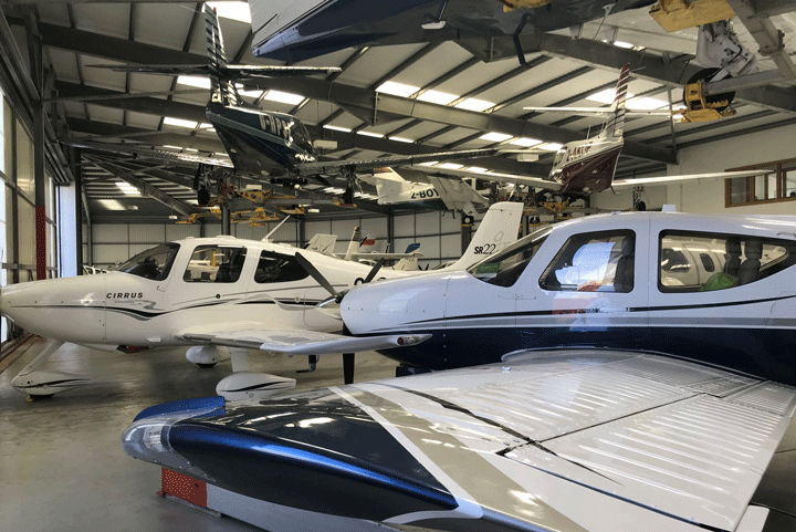
|

|

|
Conclusions from this trip:
- Descent planning: Multiply your height in thousands of feet by 3 and that's the number of minutes from your destination you should start descending, to give roughly 500ft per minute descent rate
- To control cylinder wear keep the CHT below 400deg using cowl flaps, enrichment and maybe something less then full throttle...
- Flying SIDs and STARs is very easy, but requires pre-briefing and good cockpit organisation
- The Comm box has a split COM1/COM2 button allowing P1 and P2 separate transmit/receive channels. So P1 can be talking to ATC whilst P2 can be talking to Handling on the ground, ordering fuel prior to landing.
- The Comm box has a push-to-operate "Crew" function which isolates the pax in the back and allows them to chat while you get on with talking to ATC. Very useful.
Bournemouth - Cherbourg - Poitiers - Agen - La Rochelle - Jersey - Bournemouth Aug 19
It’s interesting that the things you worry about are not the ones that will cause you problems.......
Our plan today is to fly to France with daughter and son-in-law plus our Pet Passport-equipped dog Basil.
A great deal of research has concluded that pets, even those with pet passports, cannot be brought in to the UK by private aircraft.
This is one of those ludicrous bureaucratic nonsenses the EU, Border Force and DEFRA have simply swept under the carpet. If we were a commercial organisation we could apply to be a DEFRA-approved animal transport organisation but private flights are specifically excluded from this process. I do get the whole "we don't want rabies in the UK" thing but I think these guys need to start trusting us a little....
However, there appear to be no rules anyone can find involving exporting a dog to the EU. As the others are returning via EuroTunnel he can re-enter the UK with them. Problem more or less solved.
However, I am well aware that a lot of this falls to Immigration officials’ interpretation of the rules and that an over-zealous interpretation by some pseudo-military Douanier in France could wreck our entire day, hence the concern.
Weather is also a concern, as is weight. Four people plus dog, raft and suitcases weigh a lot and despite the C182’s reputation of “if it fits it flies” we do need to be careful with the fuel.
Basil, our bladders and the fuel tanks mean we cannot do Agen in one hop, so the plan is to stop every hour.
We plan for Bournemouth to pick up Lucy and Tom (another wallet-busting experience with Bliss Aviation...), Dinard then La Rochelle, then Agen.
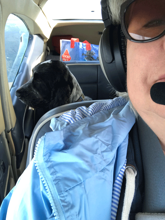
|
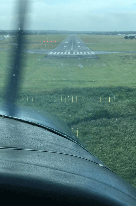
|
|---|---|
However, circumstances intervene.......
The night before departure an email to Dinard requesting Customs elicits an early morning reply stating archly that they require 24 hours Prior Notice, and that failure to comply will result in criminal prosecution.
Not a great start.
A frantic re-plan at Oxford tells us that despite dire warnings to the opposite Cherbourg does not require any Prior Notice other than a GAR and flight plan, which can be hastily arranged.
Onlinegar.com and SkyDemon make this a 5 minute job as opposed to a 2 hour slog.
Depart Oxford and via Compton head South West climbing through scattered clouds to 2500ft then joining Bournemouth right base for runway 26. Winds have been strong and the TV weather forecast would have you believe aviation is impossible today, but on approach only light winds and the odd bit of turbulence appears, now let’s see if we can do a really good landing here. Rather than land long and hurried I’m determined to land near the numbers and be a bit more controlled about the whole thing. And that works.
At Bournemouth they are just completely unfazed by the dog (I suppose they get a lot of Channel Islands departures) so we load up and depart.
I reckon we are at or maybe just a little bit over MAUW so 1 stage of flap and delay rotate to 70Kts. Despite my concerns the C182 leaps in to the air and whilst our climb performance is nothing to write home about it’s certainly no slouch.
We’re almost immediately IMC over the sea and climb to 3500ft as the clouds clear for the surprisingly short crossing to Cherbourg.
Cherbourg has been solid IMC since last night but in the last hour as forecasted it has cleared to overcast at 2000ft so we avoid the Live mid-Channel Danger Zone and descend as the French coast appears ahead.
Cleared Right Base for runway 28, I wonder how this heavily laden aircraft will land?
We’ve got the remnants of a storm gusting from the left at 16kts so fly the whole approach sideways, keep a little trace of power in the flare as it does feel heavy, kick it straight at about 8ft and......that’s as perfect a crosswind landing as it gets.
Park up and let’s see what the Douaniers say.
To say the place is deserted is to overstate the personnel. No Customs, no Immigration, no one here...... Just one bored pompier who charges us €13 for landing. He doesn’t even glance at Basil: Not His Job.
What the hell was I worried about?
Now: time to plan the next steps carefully: We stop for coffee while I think lots. Whilst Cherbourg is VFR everything South of here including La Rochelle is socked in solid for the next 6 hours down to around Limoges.
I’d prefer to stop earlier than that to even the legs out at around 1hr and get fuel at the next stop, as we have insufficient fuel to make Agen.
Poitiers is however forecasting marginal VFR but windy in about 90 minutes’ time so that’s where we’ll go, with Limoges as our alternate (We know that’s OVC2000).
But Poitiers is showing as closed Saturdays, so I call them. Like all French airfields they are of course open even if no one is there, but the helpful guy tells us the self service Air BP pumps work on a Saturday.
It’s a deal.
Another take off and we head South, French ATC being its normal efficient self. But soon the weather closes in and here is the essential issue: everywhere South says they’ve got 800ft cloudbases so to stay legal I should scud run for 90 minutes. Or, more safely, climb to 3000ft which is well above MSA and just bore our way through the clag to Poitiers. I know which I think is safer....
Every 20 minutes or so the grey room gives way to intermittent views of the rainy ground and 15 miles or so from Poitiers I can descend visually to the forecast 1200ft cloud base perfectly safely and continue VFR, which is of course much bumpier.
As we approach Poitiers the cloud base starts to fall to 800ft but there are no hills here, we can see and avoid the wind turbines and it’s stopped raining.
As we close right base for runway 21 it looms up so we report visual, quick pre- landing checks and we’re on Final in a 28Kt gale but it’s straight down the runway and our arrival is smooth and short.
Taxy for what seems like miles, whizz over to the pumps and shut down.
Basil does the most enormous wee behind the pumps and I have to say, so do I.
Again, this requires careful fuel management. A pre-fuelling dip reveals 15 USG remaining (enough for 1hr more flight; this would have got us to Limoges but not Agen).
The AirBP card works its magic but fails to give me a receipt and we’re now good to go to Agen but heavy again.
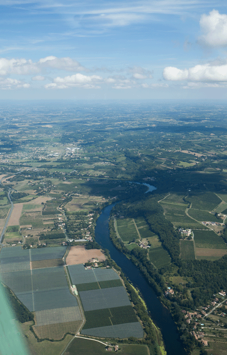 Everything in the terminal is fermée; fortunately we brought sandwiches and cold sausages which we have to eat by the pumps (it's glamorous, this aviation lark....), then we load up and taxy out, backtrack which seems silly but I’d look a clot running out of runway, roll and it is certainly reluctant to climb but we’re OK. Back in to the murk at 1200ft and climb above MSA; 10 minutes later the weather starts to clear and as forecast we fly through scattered clouds, then within 30 minutes it becomes clear blue skies and starts to get really warm and quite thermally.
Despite all the vents being open it’s pretty warm with 4 people and a dog and unfortunately poor Tom is then sick which is the first time I’ve ever experienced an ill passenger. Fortunately we have sick bags but it’s not pleasant for him.
The town of Agen soon appears and we join right downwind for runway 32, extending to allow a Robin in left base. He is still on the runway as we turn Final, still faffing about as we clear the road, then the trees, then the extended threshold but he finally turns off as we flare, maybe we frightened him away.
Smooth flare, gentle arrival, a bit long but otherwise perfect. So that’s 4 really good landings today.
The airfield, apart from the man in the tower, is utterly deserted except for the Aero Club who, strangely, are incredibly uninterested in letting us out in to the car park. We eventually discover a gate with a hinged cover concealing some numbers, which seem to work to get us out, and by experiment we learn we can use them to get back in again.
OK, so that’s that problem solved.
Apart from some misunderstanding concerning the timing of the hire car, all has been easy and at no time has felt dangerous. And my opinion of the C182 has risen yet another notch.
We’re feeling very relaxed after a week doing very little in France. Work has barely intruded and the sun has come out, so apart from the heat and the thermals I’m worried about nothing.
Basil and Ness are going home by car so we are 3 up, allowing us to carry more fuel.
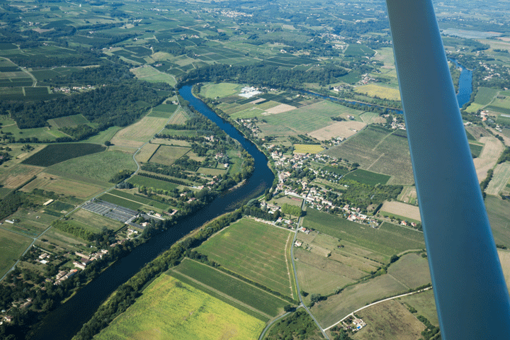 The first challenge, of course, is getting inside the bloody airfield. The codes we carefully photographed now do not work from the outside, and the man in the Aero Club is absolutely no help at all: he can’t speak any English (well, of course he can: he’s just messing with us), and won’t let us through to airside. Only when a second pilot arrives and we explain our situation to him does he let us through past the other surly, scowling miserable bastard. That’s one of the very few unpleasant Frenchmen I have met.
Once airside, our second challenge becomes apparent: despite an email confirming and the published documentation from the airfield also confirming, the fuel pump takes neither Visa nor AirBP. It only takes Total cards. Great.....
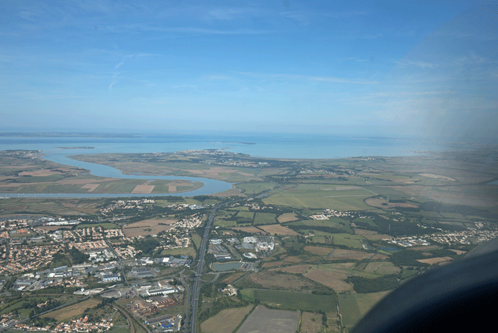 Fortunately, I did put quite a lot of fuel in when we stopped at Poitiers so we can easily make La Rochelle. But it does go to show that you cannot trust the published info!
After lengthy negotiation with the Tower they decide they will send us the bill for landing and parking, approve our start and off we go, switching briefly to Toulouse FIS then Aquitaine who are quite aerated about our route, quoting RA(T)s and Danger areas. After I’ve calmed them down a bit they tell me it’s centered on Bordeaux and is for the G7 summit. Well, I knew about that already and my route takes us well outside. Once that is explained they are much calmer.
We do have SkyDemon in the UK, you know.....
 The countryside flattens out, the rivers get larger and finally we can see the sea. We’ve elected to fly at 2500ft so we get a decent view and before long we’re talking to La Rochelle who suggest we fly off the coast to join right base for 09. This of course means we get a really nice view of the bridge to the Ile de Re which is full of stationary traffic trying to get on to the island. Ha!
We’re asked to keep the speed up on Final as far as possible so manage to maintain 120Kts until Short Final then pull everything and drop neatly on, slowing for the exit and taxiing round following the blue line to their “we take any card” fuelling station. Very glad to see it.
I’ve wanted to fly to La Rochelle for some time: it’s a prime destination for a bicycling weekend out of season so maybe we’ll return later. It seems very friendly.
We’ve actually managed to be early for once so our Flight Plan to Jersey is not due for another 30 minutes; a loo does not immediately present itself so we sneak in to the Aero Club via the hangar (there’s no one around) and use theirs. You can never have too much fuel or too empty a bladder......
10 minutes before our flight plan and GAR say we slip our life jackets on, start up and taxy the 25m to the Hold, enter and backtrack 27 and roll, with a gentle right turn outbound over the water head North.
It starts to get thermally around Cholet (where the others are headed, via some serious traffic jams near Bordeaux) so we climb to 4000ft where it’s much smoother. A little gentle VOR tracking in to and outbound from the ANG VOR and we’re switched to Rennes who only seem to have us on frequency so I’ll request (and get) a VFR zone transit which knocks 10 minutes off the trip.
Staggeringly, given the beautiful CAVOK day, no one seems to be flying.
 The coast appears again and we descend a bit to get a better view of Mont St Michel, glittering in the Sélune estuary.
The thermals smooth out as we coast out and can already see Jersey away in the distance. On our left are the Isles of Chausey which are French, unlike all the other Channel Islands which are British, damn it!
As we near Jersey my SkyDemon pops up a geo-located VRP chart making it blindingly obvious exactly where the Corbiere lighthouse is that we’ve been cleared to. You’ve got to love SkyDemon.
A picture perfect approach is followed by a complete mess of a landing. Whether I catch a gust, some wake turbulence off the departing Gulfstream or shouldn’t be allowed within 50ft of a Cessna I do not know.
Anyway, I bounce it.
I’ve done this enough times that instinct slams the throttle wide open to re-energise the wing then you either go round, or if there’s enough runway remaining, flare again. There’s loads of runway so a gentle flare and we’re smoothly on, taking the high speed exit to the Aero Club. That felt awful: you’re only ever as good as your last landing....
The aircraft park is very full but I find a slot right at the back and shut down, ask Mr AvGas to fill to nearly full and nip off for lunch and a cheeky flight plan. What of course I completely forget to do is raise another bloody GAR. I had completely forgotten about this.....
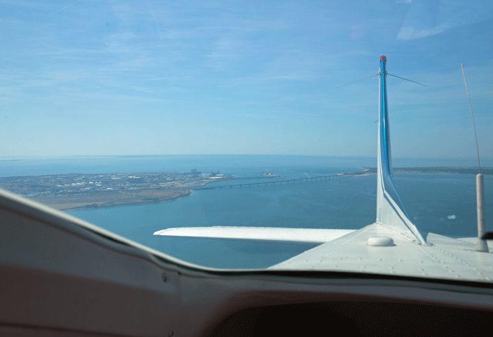
|
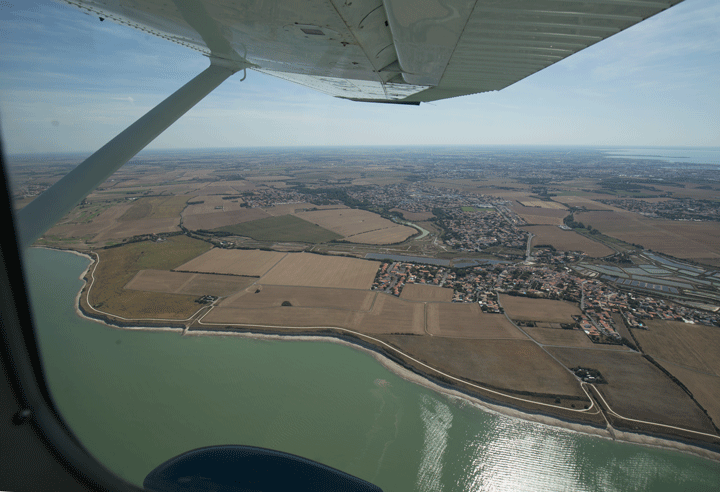
|
|---|---|

|
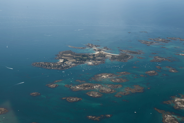
|
After lunch we start up, get a long taxy all the way past the airliners (I love doing this) and pull up at the Hold behind a Tecnam. At this point Bournemouth call me to tell me about the missing GAR and of course the Tecnam gets cleared, disappears and my headphones are off because I’m negotiating with Bournemouth.
Two minutes earlier and I could have stopped and done it via 3G and onlinegar.com, but now I’m committed to the take off. Yuk.
I may have put too much fuel in: the aircraft is very reluctant to leave the ground so I have to force it in to ground effect then push to get 75Kts so it will climb. It does climb but painfully slowly and we don’t get above 1000ft before coasting out Northbound. Jersey enquire concerning our intentions which will need to be a “slow climb” to 3000ft! I don't think it was any heavier than earlier but it's over 30deg today and that has to have an effect. I have to open the cowl flaps a bit and richen the mixture to keep the CHTs down.
The viz is excellent: we can see the whole of the Cotentin peninsula and huge numbers of white sails, then tankers and cargo vessels as we cross the shipping lanes, swap to UK Airspace proper at ORTAC and try to raise Bournemouth.
At 25 miles we get success, descend right base for 08 and do another lousy landing. No bounces, but I’m drifting off the centreline and the whole thing feels unsettled.
We taxy in and the Marshaller appears absolutely determined to taxy me in to the side of a parked twin or the fuel bowser. In the end I have to shut down and get him to understand he damned nearly caused a very expensive accident.
After yet another wallet-busting visit to Bliss (Cherbourg was €13: get a grip) I’m alone for the final run back to Oxford.
The late afternoon sun is still hot as I depart, the aircraft climbs better with one up and I climb out past Stoney Cross, switch to Farnborough with a Listening Squawk and look out for the Didcot cooling towers..... which of course now don’t exist as they blew them up last week! I’ll miss these landmarks: the central chimney is still there for now but soon we’ll have to actually learn to navigate properly around Southern Oxfordshire....
Join downwind for runway 19, and get..... a bouncy, rubbishy arrival. Some days you can land, and some days you just can’t.
On unpacking the aircraft I may have found the issue: they put two huge and heavy bags of French sirope bottles right at the back of the baggage compartment: I suspect I might have been right at the back of the W&B curve there. Hmmmmm.
Cherbourg 24 Nov 23
Some of the members of my old C182 group are coming down to Henstridge to return a couple of Sennheiser headsets I'd mistakenly left back at Oxford. Well, any excuse for aviation...
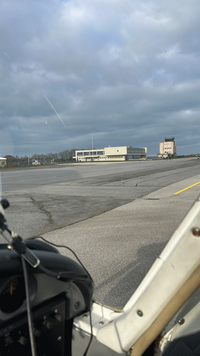 But the café at Henstridge, whilst physically open, does not serve food during the week. Whilst the guys have said they will bring sandwiches it would be nice to offer them something special as well..... like, say, warm, fresh, French Croissants. Sounds like an excuse for a trip to Cherbourg this morning.
Nowadays of course the paperwork required to go cross-channel precludes a spur of the moment decision, but given 24 hours Notice it's doable.
So, a quick check list:
GARs (via onlinegar.com, who also send a request to Customs at Cherbourg)
Weather both sides of the Channel from SkyDemon and BBC Weather
Flight Plans in both directions from Skydemon
Route, from Skydemon, via Swanage, through the gap between the Danger Area and Jersey's airspace
Fuel Planning: we'll fill up, which WBPro puts us at MAUW
E-mail to the airfield owner the night before requesting early fuel
Post-flight website log
Passports!
Legally we must also carry the aircraft documentation, my Pilot's Licence and a spare pair of glasses
I'll fly and my co-owner will do the radio, we'll swap over coming back.
At last I have remembered to bring a white USB charger lead for my iPad and/or iPhone so releasing me from the battery anxiety I always suffer when my navigation instruments are not being charged, and the new USB fag lighter adapter works, so that's one more thing sorted.
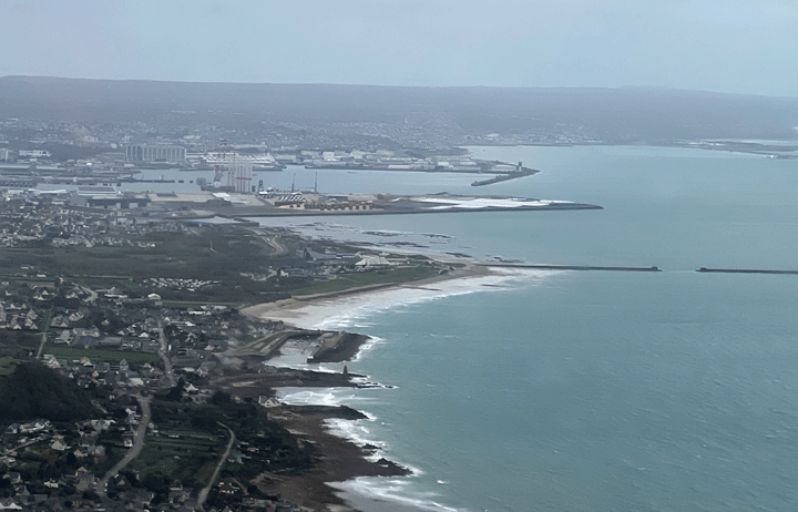
The Carb heat has been neatly repaired since our last trip so now we have a fully working aircraft and the owner of the airfield has kindly opened the pump up early so following copious visual and functional tests of the new carb heat cable we can fire up, taxy to the pumps, fill all the way to the brim, power check at the Hold, backtrack and depart on time.
Being at MAUW makes the aircraft sluggish to accelerate on the runway, sluggish to rotate and sluggish to climb away. I'll give it an extra 5Kts before rotate and let it fly itself off, lose the flaps at 800ft and accept the lower climb rate as a trade against plenty of range - Alternates are officially Caen and Alderney but in practice if we can't land at Cherbourg I want enough fuel to get back across the Channel to Henstridge.
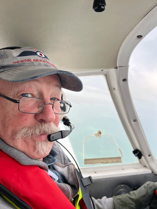 Turning South, Bournemouth open our Flight Plan and advise we can cross the smaller Danger Area near Swanage, which allows us to cut the corner, not that it saves much time but every little helps, although as we have a stonking tailwind we'll be there plenty early!
There is a solid cloud layer at 3,500ft so we'll punch up through it and at 5,000ft the sun comes out. Ah, that's better. That's why you need an IR(R).
As we pass to London Info for the crossing we can hear a PA28 from Compton Abbas behind us also heading for Cherbourg. He's clearly making better time than us as he's a Warrior and we are merely a Cherokee.
We pass through the Danger Area / Jersey gap and swap to what was Brest and is now Rennes, who just can't get our callsign right no matter how many times we repeat it. They are talking mainly in French which, as we all know, is in contravention of ICAO rules stating that all calls will be made in English. Ah well, the French are a law unto themselves.
Approaching the French coast we do a gentle descent through the cloud layer, again in contravention of ICAO rules, as I don't have a French IR. If asked, we "found a hole".... MSA over the sea is 1000ft and we know the cloud base is 3,500ft so it's safe, even though the Warrior is somewhere quite close he has already descended. As he is sounding a little close as we change to Cherbourg Approach we decide to let him go and do a single orbit for spacing.
We can join Right Base for Runway 28. There's a sprightly crosswind from the right and this is the first time I've done a proper crosswind landing in this aircraft but keep it crabbed until we flare, push the rudder and we drop on neatly with only 2Km of runway to spare...
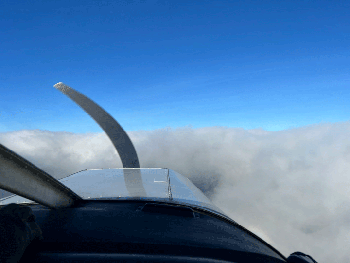 Entering the terminal we neet the two jovial French Passport guys who stamp my co-owner's passport and laugh at my Spanish residency documents: I don't need to be stamped.
Pay the Tax d'aterrisage, and in to the Le Tarmac café for well-earned coffee and croissants.... but they have no croissants! How am I going to feed my friends?
I should really have programmed in enough time to get a taxi to the local Boulangerie in Le Marais (7Kms away) but I assumed the café would have them. Oh well....
My co-owner will fly us back so we return to the plane, call for start and it turns out (doh!) I have put the wrong time on the return Flight Plan - it is for an hour hence, not now. However, the Tower is very helpful and quickly changes it so we can start and taxy out.
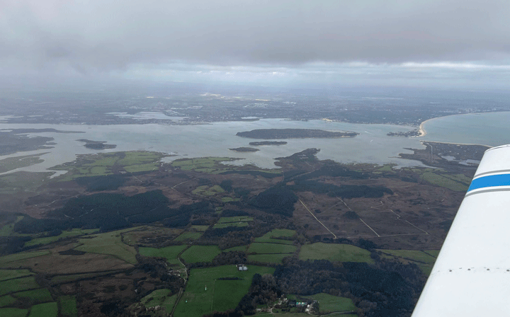
On climb out we need to climb through the cloud layer to the the sunshine. His IR(R) has lapsed so we will "borrow" mine. It's interesting to see him struggle with speed, climb rate and heading. At one point he gets quite slow, but we make it up through the murk safely and in the right direction. However, our ground speed is down to 63Kts.... it will be a longer journey back.
We thread the Danger Area / Jersey needle and swap back to London Info who again clear us through the Danger Area around Swanage but (and this becomes important later) sets no minimum altitude for the crossing.
There is an Airway above us at FL55, and we are at 5,200ft just above the clouds. The clouds are offering variable amounts of lift and it is hard to keep a constant altitude. Our altitude drifts above 5,500ft a couple of times, which is not ideal but Airways are calculated using 1013HPa. We are on a QNH of 1022HPa and the old "High to low, down you go" rule gives us an extra 243ft (9 x 27ft) of wiggle room, but it's tight.
 As we approach Bournemouth our ground speed is still low so we descend through the murk to 3,000ft on the theory that the headwind will be less beneath the clouds. Our ground speed improves to 85Kts but as we change to Bournemouth and coast in they tell us we should not be below 3,500ft over the Danger Area. We immediately climb to 3,600ft and apologise, and we don't get hit by any small arms fire!
We swap back to Henstridge and discuss landing options. The wind is right across the runway from the North West. Normally we would land on runway 24: the approach is easier. But a landing aircraft ahead of us says they are using 06 as the wind is marginally favouring it. It will be interesting to see my co-owner cope with a crosswind landing.
It is gusty as he descends on Final, but he does an excellent job of dropping it on in a drama-free manner and we taxy in, avoiding the working party who have a wheelbarrow and are working on the airfield lights. Lights? We have lights? Apparently they are for the Air Ambulance, but I'm thinking "Pilot operated lighting!". Henstridge's admin details say "Sunrise to Sunset", however, which is a shame.
However, Henstridge is to get an RNAV instrument approach in support of the Air Ambulance. It won't be this year, but does beg the question "how might we use it?" Fox Zulu has no Garmin 430 but SkyDemon offers a virtual ILS display in the form of a CDI. But does it offer virtual guidance? I have a friend who has "rolled his own" RNAV approach and happily flies it to Minimums of 400ft AGL, so I think if one was to set sensible Minima this may be a way forward: experimentation will be required.
My co-owner is exhausted; he says the whole flight was "stretching" as he's not been to Cherbourg for a very long time.